Broken Bay
Bays of New South WalesCentral Coast (New South Wales)Coastline of New South WalesNorthern BeachesUse Australian English from September 2012

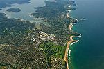
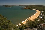
Broken Bay, a semi-mature tide-dominated drowned valley estuary, is a large inlet of the Tasman Sea located about 50 kilometres (31 mi) north of Sydney central business district on the coast of New South Wales, Australia; being one of the bodies of water that separate greater Metropolitan Sydney from the Central Coast. Broken Bay is the first major bay north of Sydney Harbour. Broken Bay has its origin at the confluence of the Hawkesbury River, Pittwater, and Brisbane Water and flows openly into the Tasman Sea. The total surface area of the bay is approximately 17.1 square kilometres (6.6 sq mi).
Excerpt from the Wikipedia article Broken Bay (License: CC BY-SA 3.0, Authors, Images).Broken Bay
Central Coast Council
Geographical coordinates (GPS) Address Nearby Places Show on map
Geographical coordinates (GPS)
| Latitude | Longitude |
|---|---|
| N -33.568611111111 ° | E 151.31666666667 ° |
Address
Box Head
2257 Central Coast Council, Box Head
New South Wales, Australia
Open on Google Maps


