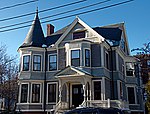
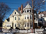
Davis Square

Davis Square is a major intersection in the northwestern section of Somerville, Massachusetts where several streets meet: Holland Street, Dover Street, Day Street, Elm Street, Highland Avenue, and College Avenue. The name is often used to refer to the West Somerville neighborhood surrounding the square as well. Davis Square is located approximately four miles from downtown Boston, and two miles from mid-Cambridge. The square is served by the Davis Square Station, one of the stops on the Massachusetts Bay Transportation Authority (MBTA)'s Red Line. Davis abuts the Powder House Square, Magoun Square and Spring Hill neighborhoods, as well as Tufts University.Davis Square is today a vibrant commercial, retail, nightlife and dining district. Businesses in Davis range from stores to restaurants to even a martial arts school. Davis fell into decline after World War II. After the Red Line was extended to Davis in the mid-1980s, however, the area began to experience a prolonged renaissance.
Excerpt from the Wikipedia article Davis Square (License: CC BY-SA 3.0, Authors, Images).Davis Square
College Avenue, Somerville
Geographical coordinates (GPS) Address Nearby Places Show on map
Geographical coordinates (GPS)
| Latitude | Longitude |
|---|---|
| N 42.39638 ° | E -71.12226 ° |
Address
College Avenue
College Avenue
02144 Somerville
Massachusetts, United States
Open on Google Maps


