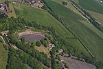
RAF Swingate Down
Royal Air Force stations in Kent
Royal Air Force Swingate Down or more simply RAF Swingate Down is a former Royal Air Force Chain Home Low radar station operational during the Second World War located north of Dover, Kent, England. The site was situated on alongside RAF Dover, another Radar section together on the removed First World War landing ground of RAF Dover.
Excerpt from the Wikipedia article RAF Swingate Down (License: CC BY-SA 3.0, Authors).RAF Swingate Down
Upper Road,
Geographical coordinates (GPS) Address Nearby Places Show on map
Geographical coordinates (GPS)
| Latitude | Longitude |
|---|---|
| N 51.139444444444 ° | E 1.3416666666667 ° |
Address
Upper Road
CT15 6HY
England, United Kingdom
Open on Google Maps


