place

Alum Chine explosion

1913 disasters in the United States1913 fires in the United States1913 in MarylandExplosions in 1913Industrial fires and explosions in the United States
March 1913 events in the United StatesMaritime incidents in 1913Ship fires

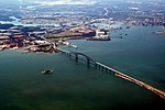
The Alum Chine explosion was a disaster that occurred in the Patapsco River near Baltimore, Maryland on March 7, 1913. The tramp steamer Alum Chine exploded while loading dynamite, killing 33 and injuring 60.

Excerpt from the Wikipedia article Alum Chine explosion (License: CC BY-SA 3.0, Authors).

Alum Chine explosion
Baltimore

Geographical coordinates (GPS) Address Website Nearby Places
placeShow on map

Wikipedia: Alum Chine explosionContinue reading on Wikipedia

Geographical coordinates (GPS)

Latitude Longitude
N 39.221391 ° E -76.558255 °
placeShow on map

Address

Baltimore


Baltimore
Maryland, United States
mapOpen on Google Maps

Website
baltimorecity.gov

linkVisit website

Share experience

Nearby Places

Curtis Bay, Baltimore

Curtis Bay is a residential / commercial / industrial neighborhood in the southern portion of the City of Baltimore, Maryland, United States. The neighborhood is on steep sloping heights, about four city blocks wide (west to east) and fifteen blocks long (north to south) and above and surrounded on three sides (northeast - east - southeast) in a highly industrialized waterfront area in the southern part of the city, and receives its name from the body (cove) of water to the east in which it sits. The cove of "Curtis Bay" with two small branches - Stone House Cove and Cabin Branch is fed from the southwest by Curtis Creek which in turn is formed further south by Marley Creek and Furnace Branch/Creek in Anne Arundel County. Adjoining nearby to the east is Thoms Cove near Hawkins Point at the north end of the Marley Neck peninsula. Curtis Bay cove itself also has a dredged deep water channel with considerable port facilities and waterfront industries and is a branch of the main stem of the Patapsco River, which forms the extensive frontage of Baltimore Harbor and Port, northwest off of the Chesapeake Bay. The residential community of Curtis Bay is along three major north–south thoroughfares of Curtis Avenue, Pennington Avenue (Maryland Route 173 on which most commercial businesses are located) and residential Fairhaven Avenue and a partial street of Prudence Street. Running west to east are fifteen smaller residential streets named alphabetically for various types of trees. "The Bay", as it is often called colloquially, also offers a variety of housing, townhouses, rowhouses, individual homes, (both constructed of wood-frame, brick, stone and concrete block/stuccoed) and corner stores, taverns/bars. Curtis Bay is also home since 1897 to the United States Coast Guard Yard (formerly the U.S. Revenue Cutter Service until 1915) on Hawkins Point Road / extending south from Pennington Avenue (Maryland Route 173) on Arundel Cove off Curtis Creek on the border line with neighboring suburban Anne Arundel County to the south. During the middle and late 19th and early 20th centuries, a Quarantine Station and lazaretto run by the United States Government agency (future U.S. Public Health Service) along Thoms Cove between Sledds Point and Hawkins Point. There is a large Polish American community in Curtis Bay. The former town hall, real estate office, volunteer fire station, and meeting/assembly hall on the second floor for Curtis Bay was constructed on the heights overlooking the new town and rapidly developing industrial waterfront along Fairview Avenue (now Fairhaven Avenue) facing Filbert Street by a successor developing firm, the South Baltimore Harbor and Improvement Company in 1905. In 1925, the United Polish Societies purchased the building and named it Polish Home Hall and it became central to the Polish ethnic experience in Curtis Bay, functioning as a social, educational, and political center for Curtis Bay's Polish community into the 1970s.

Bethlehem Fairfield Shipyard

The Bethlehem-Fairfield Shipyard of Baltimore, Maryland, was a shipyard in the United States from 1941 until 1945. Located on the south shore of the Middle Branch of the Patapsco River which serves as the Baltimore Harbor, it was owned by the Bethlehem Shipbuilding Company, created by the Bethlehem Steel Corporation of Bethlehem, Pennsylvania, which had operated a major waterfront steel mill outside Baltimore to the southeast at Sparrows Point, Maryland in Baltimore County since the 1880s. The yard is now the location to the west of several heavy industrial firms with a focus on petro-chemicals, a later Maryland Shipbuilding and Drydock Company, which endured into the 1990s, and the underground south entrance of the Baltimore Harbor Tunnel, built in 1956–1957, carrying Interstate 895 and the Baltimore Harbor Tunnel Thruway through and under the city in the major East Coast thoroughfare. Bethlehem-Fairfield was one of two new emergency shipyards, established by the Maritime Commission under the Emergency Shipbuilding program, in 1941. The other shipyard was the Oregon Shipbuilding Corporation, Portland, Oregon.Because Baltimore Harbor is so old (dating to 1706) there was not sufficient space to build both the shipways and the fabrication plant in the same waterfront area. The fabricating plant was only less than two miles away further south in adjacent Curtis Bay at a former George Pullman railroad car wheel foundry dating from 1887, greatly expanded in 1916, with massive huge shops before World War I, but now empty during the Great Depression of the 1930s. This proved an advantageous situation though, which was better than other shipyards on the East Coast whose fabricating plants were usually located some further miles away. This allowed for easy transportation by railroad cars of the Baltimore and Ohio Railroad through its Curtis Bay Yards of the preassembled components and other sections needed for the assembly of the ship hulls to the storage yard at Fairfield where they would later be moved by cranes to one of the 13 ways used for erecting the ships, this was later expanded to 16 ways. Additional thousands of temporary wood-frame style barracks were constructed plus standardized brick row homes and housing projects soon filled woods and meadows of the neighboring Brooklyn-Curtis Bay-Fairfield-Wagner's Point waterfront communities dating to 1853 / 1887 / 1890s in southern Baltimore city, recently annexed in 1919 from neighboring rural Anne Arundel CountyOn 27 September, 1941, Fairfield hosted Liberty Fleet Day, with the launching of their first Liberty Ship, SS Patrick Henry. She was the first of an eventual 384 Liberty ships built there, along with 45 LSTs, and 94 Victory ships.