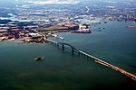
The Francis Scott Key Bridge, also known originally as the Outer Harbor Crossing (until renamed for FSK in 1977) or simply as the Key Bridge or Beltway Bridge, is a steel arch-shaped continuous through truss bridge spanning the lower Patapsco River and outer Baltimore Harbor / Port carrying Maryland Route 695 in Baltimore, Maryland, United States. The main span of 1,200 feet (366 m) is the third longest span of any continuous truss in the world. It is also the longest bridge in the Baltimore metropolitan area.
The bridge was opened in March 1977 and is named for the author of the American national anthem, the poem originally called "The Defence of Fort McHenry" written in September 1814 and later set to music and entitled the "Star Spangled Banner" by Frederick and Georgetown lawyer /amateur poet Francis Scott Key (1779–1843). The bridge is the outermost of three toll crossings of Baltimore's Harbor (two tunnels and one bridge). Upon completion, the bridge structure and its approaches became the final links in Interstate 695 (the "Baltimore Beltway"), completing a two decades long project. Despite the I-695 signage, the bridge is officially considered part of the state highway system and designated Maryland Route 695.The bridge is 8,636 feet (2,632 m) long and carries an estimated 11.5 million vehicles annually. It is a designated hazardous materials truck route, as HAZMATs are prohibited in the Baltimore Harbor and Fort McHenry tunnels.
The Key Bridge is a toll facility operated by the Maryland Transportation Authority (MDTA). The toll rate for cars as of July 1, 2013 is $4.00. The bridge is also part of the E-ZPass system, and includes two dedicated E-ZPass lanes in its toll plaza in both the northbound and southbound directions. In April 2019, MDTA announced that the bridge will become a cashless toll facility by October 2019. With this system, customers without E-ZPass pay using video tolling. Cashless tolling began on the bridge on October 30, 2019.


