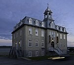
Rivière des Sept Crans
The Rivière des Sept Crans (English: river of the seven escarpments) is a tributary of the rivière aux Chiens. It flows on the north shore of the Saint Lawrence river, in the unorganized territory of Lac-Jacques-Cartier, as well as the municipalities of Beaupré and Château-Richer, in the La Côte-de-Beaupré Regional County Municipality in the administrative region of Capitale-Nationale, in the province of Quebec, in Canada. This small valley is served by the D'Auteuil road which passes on the east side of the river. Forestry is the main economic activity in this valley; second-hand tourist activities. The surface of the Sept Crans river is generally frozen from the beginning of December until the end of March; however, safe traffic on the ice is generally from mid-December to mid-March. The water level of the river varies with the seasons and the precipitation; the spring flood occurs in March or April.
Excerpt from the Wikipedia article Rivière des Sept Crans (License: CC BY-SA 3.0, Authors).Rivière des Sept Crans
Chemin Royal,
Geographical coordinates (GPS) Address Nearby Places Show on map
 Continue reading on Wikipedia
 Geographical coordinates (GPS)
| Latitude | Longitude |
|---|---|
| N 46.92916 ° | E -71.01844 ° |
Address
Chemin Royal 3037
G0A 2K0
Quebec, Canada
Open on Google Maps