Ebony, Kent
Hamlets in KentKent geography stubsVillages in the Borough of Ashford
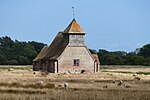
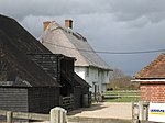
Ebony is a hamlet south of Ashford in Kent, South East England, in the civil parish of Stone-cum-Ebony, on the Isle of Oxney in the Ashford district of Kent. EBONY (St. Mary), is a parish, in the union of Tenterden, partly in the hundred of Tenterden, Lower division of the lathe of Scray, W. division, but chiefly in the hundred of Oxney, lathe of Shepway, E. division, of Kent, 4 miles (S. E.) from Tenterden. [1] The place-name 'Ebony' is first attested in a Saxon charter of 833, where it appears as Ebbanea. The name means 'Ebba's or Ybba's stream'.
Excerpt from the Wikipedia article Ebony, Kent (License: CC BY-SA 3.0, Authors).Ebony, Kent
Forge Meadow,
Geographical coordinates (GPS) Address Nearby Places Show on map
Geographical coordinates (GPS)
| Latitude | Longitude |
|---|---|
| N 51.0167 ° | E 0.7654 ° |
Address
Forge Meadow
Forge Meadow
TN30 7JP , Stone-cum-Ebony
England, United Kingdom
Open on Google Maps


