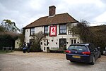
Fairfield, Kent
Folkestone and Hythe DistrictFormer civil parishes in KentKent geography stubsVillages in Kent

Fairfield is a village and former civil parish, now in the parish of Snargate, in the Folkestone and Hythe district of Kent, England. In 1931 the parish had a population of 61. On 1 April 1934 the parish was abolished and merged with Snargate, part also went to Stone cum Ebony. The area lies west of the village of Brookland. It is in the Church of England parish of Brookland and Fairfield on Walland Marsh (part of Romney Marsh).
Excerpt from the Wikipedia article Fairfield, Kent (License: CC BY-SA 3.0, Authors, Images).Fairfield, Kent
Folkestone and Hythe District
Geographical coordinates (GPS) Address Nearby Places Show on map
Geographical coordinates (GPS)
| Latitude | Longitude |
|---|---|
| N 51.005 ° | E 0.798 ° |
Address
TN29 9RZ Folkestone and Hythe District
England, United Kingdom
Open on Google Maps


