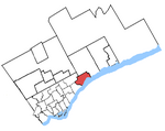
Port Union, Toronto

Port Union, also known as Centennial Scarborough is a neighbourhood in Toronto, Ontario, Canada. It is located in the south-east corner of Toronto, within the former suburb of Scarborough. The neighbourhood is bounded by Kingston Road to the north, Port Union Road to the east, the Lake Ontario shoreline to the south, and Highland Creek to the west. The neighbourhood originated as the small lakefront town of Port Union in the 19th century, within the area now known as West Rouge, until 1974 part of the Township of Pickering. It was later developed as a suburban bedroom community after the Second World War. Since the 1990s, the industrial lands along the waterfront have been transformed into new subdivisions, along with a paved walkway and bike path along the shore of Lake Ontario. The neighbourhood has many mature trees, parkland and waterfront. It is an affluent neighbourhood with 93% home ownership.
Excerpt from the Wikipedia article Port Union, Toronto (License: CC BY-SA 3.0, Authors, Images).Port Union, Toronto
Provincetown Road, Toronto Scarborough
Geographical coordinates (GPS) Address Nearby Places Show on map
Geographical coordinates (GPS)
| Latitude | Longitude |
|---|---|
| N 43.778888888889 ° | E -79.134166666667 ° |
Address
Provincetown Road 33
M1C 3B2 Toronto, Scarborough
Ontario, Canada
Open on Google Maps


