place

Winchell Trail

AC with 0 elementsHiking trails in MinnesotaMississippi GorgeMississippi National River and Recreation AreaNational Recreation Trails in Minnesota
Parks in MinneapolisProtected areas of Hennepin County, MinnesotaWorks Progress Administration in Minnesota
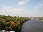
Winchell Trail in Minneapolis early spring 2020

Winchell Trail is a five-mile (8 km) round trip, pedestrian-only trail in Minneapolis, Minnesota, United States, that runs along the west side of the Mississippi River between Franklin Avenue South and East 44th Street. Popular with bird watchers and naturalists, the rustic trail provides Upper Mississippi River gorge access and views. The trail is separate from the adjacent multi-use bicycle path, taking hikers past sandy beaches, an oak savanna restoration project, and the floodplain forest. The trail has multiple access points and the section from East 38th Street to East 44th Street is paved. Described as moderate and for all hiking skill levels, the out-and-back Winchell Trail has total elevation gain of 501 feet (153 m). Portions of the trail can be hiked in near solitude as its age and general destitute make it a widely forgotten place to explore.

Excerpt from the Wikipedia article Winchell Trail (License: CC BY-SA 3.0, Authors, Images).

Winchell Trail
West River Parkway Trail, Minneapolis

Geographical coordinates (GPS) Address Nearby Places
placeShow on map

Wikipedia: Winchell TrailContinue reading on Wikipedia

Geographical coordinates (GPS)

Latitude Longitude
N 44.941666666667 ° E -93.203611111111 °
placeShow on map

Address

West River Parkway Trail

West River Parkway Trail
55406 Minneapolis
Minnesota, United States
mapOpen on Google Maps

Winchell Trail in Minneapolis early spring 2020
Share experience

Nearby Places

Minneapolis–Saint Paul

Minneapolis–Saint Paul is a metropolitan area centered around the confluence of the Mississippi, Minnesota and St. Croix rivers in the U.S. state of Minnesota. It is commonly known as the Twin Cities after the area's two largest cities, Minneapolis and Saint Paul. Minnesotans often refer to the two together (or the seven-county metro area collectively) simply as "the cities". It is Minnesota’s economic, cultural, and political center. Minneapolis and Saint Paul are independent municipalities with defined borders. Minneapolis sits mostly on the west side of the Mississippi River on lake-covered terrain. Although most of the city is residential neighborhoods, it has a business-dominated downtown area with some historic industrial areas, the Mill District and the Warehouse District. Minneapolis also has a popular uptown area. Saint Paul, which sits mostly on the east side of the river, has quaint tree-lined neighborhoods, a vast collection of well-preserved late-Victorian architecture, and a number of colleges. Both cities and the surrounding areas are known for their woods, lakes, hills and creeks.Originally inhabited by the Ojibwe and Dakota people, the cities were settled by various Europeans. Minneapolis was strongly influenced by early Scandinavian and Lutheran settlers, while Saint Paul was settled predominantly by the French, the Irish, and German Catholics. Today, both urban areas are home to new immigrant communities, including Somalis, Hmong, Oromo, Cameroonians, and Liberians. "Twin Cities" is sometimes used to refer to the seven-county region governed by the Metropolitan Council regional governmental agency and planning organization. The United States Office of Management and Budget officially designates 15 counties as the "Minneapolis–St. Paul–Bloomington MN–WI Metropolitan Statistical Area". It is the 16th-largest metropolitan statistical area and third-largest metropolitan area in the Midwest, with a population of 3,690,261 at the 2020 census. The larger 21-county Minneapolis–St. Paul MN–WI Combined Statistical Area, which also ranks as the 16th-largest, had a population of 4,078,788 at the 2020 census.