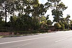
Doncaster, Victoria

Doncaster ( DONK-ah-stər) is a suburb of Melbourne, Victoria, Australia, 18 km north-east of Melbourne's Central Business District, located within the City of Manningham local government area. Doncaster recorded a population of 25,020 at the 2021 census.The suburb, which is situated on 8.9 km2 of land, around the top of the 120 m high Doncaster Hill. The suburb consists of a central area along the top of Doncaster Hill, which includes several historical buildings along Doncaster Road, the Westfield Doncaster Shopping Centre and surrounding high-rise apartments, while the rest of the suburb is typical of many of Melbourne's eastern suburbs, with extensive low-density housing. It has lots of schools and there is a planned railway station for Doncaster. Currently residents need to travel to Box Hill to get on the train towards the city.
Excerpt from the Wikipedia article Doncaster, Victoria (License: CC BY-SA 3.0, Authors, Images).Doncaster, Victoria
Williamsons Road, Melbourne Doncaster
Geographical coordinates (GPS) Address Nearby Places Show on map
Geographical coordinates (GPS)
| Latitude | Longitude |
|---|---|
| N -37.78 ° | E 145.124 ° |
Address
Williamsons Road 92
3108 Melbourne, Doncaster
Victoria, Australia
Open on Google Maps


