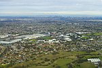
Glenroy, Victoria

Glenroy is a suburb in Melbourne, Victoria, Australia, 12 km (7.5 mi) north of Melbourne's Central Business District, located within the City of Merri-bek local government area. Glenroy recorded a population of 23,792 at the 2021 census.Glenroy is located in the northwest of the City of Merri-bek, and is bounded by the Western Ring Road in the north, the Moonee Ponds Creek in the west, New Road, Victoria Street and Rhodes Parade in the south and West Street, Hilton Street, Box Forest Road and the Upfield railway line in the east. Prominent features include the private Northern Golf Club, a major retail district centred on the Glenroy railway station and the Northern Memorial Park extension to the Fawkner General Cemetery.
Excerpt from the Wikipedia article Glenroy, Victoria (License: CC BY-SA 3.0, Authors, Images).Glenroy, Victoria
Glenroy Road, Melbourne Glenroy
Geographical coordinates (GPS) Address Nearby Places Show on map
Geographical coordinates (GPS)
| Latitude | Longitude |
|---|---|
| N -37.706 ° | E 144.924 ° |
Address
Glenroy Road
Glenroy Road
3046 Melbourne, Glenroy
Victoria, Australia
Open on Google Maps


