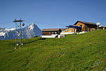
Grindelwald

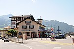
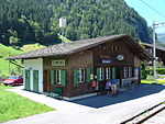
Grindelwald is a village and municipality in the Interlaken-Oberhasli administrative district in the canton of Berne. In addition to the village of Grindelwald, the municipality also includes the settlements of Alpiglen, Burglauenen, Grund, Itramen, Mühlebach, Schwendi, Tschingelberg and Wargistal. Grindelwald village is located at 1,034 m (3,392 ft) above sea level. Mentioned for the first time in 1146, it has become an important tourist destination of both Switzerland and the Alps since the golden age of alpinism in the 19th century. It is overlooked by a section of the Bernese Alps from the Wetterhorn to the Eiger, which create a natural barrier. Together with the adjacent valley of Lauterbrunnen, the valley of Grindelwald forms part of the Jungfrau Region of the Bernese Oberland, between Interlaken and the main crest of the Bernese Alps. Similarly to Lauterbrunnen, Grindelwald is connected to Interlaken by the Bernese Oberland Railway and is the start of the Wengernalp Railway, leading to Kleine Scheidegg. The latter resort is the start of the Jungfrau Railway, the highest railway in Europe and a gateway to the Jungfrau-Aletsch protected area.
Excerpt from the Wikipedia article Grindelwald (License: CC BY-SA 3.0, Authors, Images).Grindelwald
Grythstrasse,
Geographical coordinates (GPS) Address Nearby Places Show on map
Geographical coordinates (GPS)
| Latitude | Longitude |
|---|---|
| N 46.616666666667 ° | E 8.0333333333333 ° |
Address
Grythstrasse 4
3818
Bern, Switzerland
Open on Google Maps
