place

Mittellegi Hut

EigerMountain huts in SwitzerlandMountain huts in the AlpsSwiss building and structure stubs
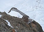
Mittellegi ridge, Eiger

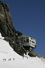
The Mittellegi Hut (German: Mittellegihütte) (3,355 m) is a mountain hut in the Swiss Alps, located on the Mittellegi ridge of the Eiger above Grindelwald. It is the highest mountain hut in the canton of Bern. Its construction was funded by Maki Yūkō, a Japanese climber, in 1924 as a memorial of his world first climb to the Eiger.

Excerpt from the Wikipedia article Mittellegi Hut (License: CC BY-SA 3.0, Authors, Images).

Geographical coordinates (GPS)

Latitude Longitude
N 46.583333333333 ° E 8.0225 °
placeShow on map

Address

Mitellegihütte (Mitellegihütte)

Eigertrail
3818
Bern, Switzerland
mapOpen on Google Maps

Phone number
Grindelwalder Bergführerverein

call+41338530366

linkWikiData (Q1770993)
linkOpenStreetMap (376355126)

Mittellegi ridge, Eiger
Share experience

Nearby Places

Eiger
Eiger

The Eiger (German pronunciation: [ˈaɪ̯ɡɐ] ) is a 3,967-metre (13,015 ft) mountain of the Bernese Alps, overlooking Grindelwald and Lauterbrunnen in the Bernese Oberland of Switzerland, just north of the main watershed and border with Valais. It is the easternmost peak of a ridge crest that extends across the Mönch to the Jungfrau at 4,158 m (13,642 ft), constituting one of the most emblematic sights of the Swiss Alps. While the northern side of the mountain rises more than 3,000 m (10,000 ft) above the two valleys of Grindelwald and Lauterbrunnen, the southern side faces the large glaciers of the Jungfrau-Aletsch area, the most glaciated region in the Alps. The most notable feature of the Eiger is its nearly 1,800-metre-high (5,900 ft) north face of rock and ice, named Eiger-Nordwand, Eigerwand or just Nordwand, which is the biggest north face in the Alps. This huge face towers over the resort of Kleine Scheidegg at its base, on the eponymous pass connecting the two valleys. The first ascent of the Eiger was made by Swiss guides Christian Almer and Peter Bohren and Irishman Charles Barrington, who climbed the west flank on August 11, 1858. The north face, the "last problem" of the Alps, considered amongst the most challenging and dangerous ascents, was first climbed in 1938 by an Austrian-German expedition. The Eiger has been highly publicized for the many tragedies involving climbing expeditions. Since 1935, at least 64 climbers have died attempting the north face, earning it the German nickname Mordwand, literally "murder(ous) wall"—a pun on its correct title of Nordwand (North Wall).Although the summit of the Eiger can be reached by experienced climbers only, a railway tunnel runs inside the mountain, and two internal stations provide easy access to viewing-windows carved into the rock face. They are both part of the Jungfrau Railway line, running from Kleine Scheidegg to the Jungfraujoch, between the Mönch and the Jungfrau, at the highest railway station in Europe. The two stations within the Eiger are Eigerwand (behind the north face) and Eismeer (behind the south face), at around 3,000 metres. The Eigerwand station has not been regularly served since 2016.

Eigerwand railway station

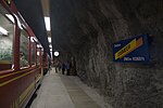
Eigerwand is a currently disused underground railway station on the Jungfrau railway, which runs to the Jungfraujoch from Kleine Scheidegg. The station is situated just behind the north wall of the Eiger, and its principal purpose was to allow passengers to observe the view through a series of windows carved into the rock face. Trains to Jungfraujoch used to stop at the station for five minutes.However, since late 2016, after the introduction of new, faster, rolling stock, the Jungfraubahn no longer stops here. Indeed, much of the 2017 publicity material fails to acknowledge that this viewpoint station ever existed. The station opened on 28 June 1903, with the extension of the Jungfraubahn from its previous temporary terminus at Rotstock station. After further construction, the line was extended to Eismeer station on 25 July 1905, and Eigerwand became an intermediate stop.Administratively, the station is in the municipality of Grindelwald in the canton of Bern. However, the only access to the station other than by train is a door in the sheer face of the mountain. This has, on occasion, been used to rescue mountaineers stranded on the mountain, most famously during the 1936 Eiger north face climbing disaster. It features in this capacity in the film The Eiger Sanction. It also lies right next to the Stollenloch, an exit and unofficial stop which is typically used by mountaineers to bypass the lower approach of the North Face.Prior to its closure, the following passenger trains operated:

Lower Grindelwald Glacier

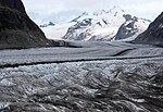
The Lower Grindelwald Glacier (German: Unterer Grindelwaldgletscher) is a Glacier in the Swiss Bernese Alps, situated to the south-east of Grindelwald. It starts below the Agassizhorn and the Strahlegghörner and is connected with the Finsteraar Glacier via the Finsteraarjoch (3,390 m (11,120 ft)). The Lower Grindelwald Glacier yet has a major tributary, the Ischmeer (Swiss German for Ice Sea, formerly known as Grindelwald-Fiescher Glacier, German: Grindelwald-Fieschergletscher), which is the glacier overlooked by the Jungfrau Railway's Eismeer railway station. The Lower Grindelwald Glacier was about 8.3 kilometres (5.2 mi) long and covered an area of 20.8 km2 (8.0 sq mi) in 1973. The glacier has significantly shrunk since, having a length of just 6.2 kilometres (3.9 mi) in 2015, with most of the retreat (1.9 km (1.2 mi)) happening since 2007.In the middle of the 19th century it clearly reached into the valley of Grindelwald as far as Mettenberg at an altitude of 983 m (3,225 ft), an eastern quarter of Grindelwald, near the conjunction of the Schwarze and Weisse Lütschine In 1900, it still reached as far as Rote Fluh (1,200 m (3,900 ft)) and filled the entire valley of its current end, the glacier lake, with a thickness of about 300 metres (980 ft) up to an altitude of 1,700 metres (5,600 ft), just below the current hiking path around the Bänisegg. Around 2000 it still reached into the gorge between the Hörnli (Eiger) and Mättenberg. The Lower Grindelwald Glacier should not be confused with the Upper Grindelwald Glacier, situated to its north-east. The Grindelwald-Fiescher Glacier should not be confused with the like-named Fiescher Glacier, to the south of the Fiescherhorn.