Mont Albert, Victoria
Suburbs of MelbourneUse Australian English from August 2019

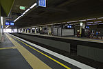
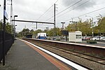
Mont Albert is an inner eastern suburb of Melbourne, Victoria, Australia, 12 kilometres east of Melbourne's Central Business District, located within the Cities of Boroondara and Whitehorse local government areas. Mont Albert recorded a population of 4,948 at the 2021 census.The main shopping centre of Mont Albert is Hamilton Street, a small street lined with shops. The suburb has its own railway station.
Excerpt from the Wikipedia article Mont Albert, Victoria (License: CC BY-SA 3.0, Authors, Images).Mont Albert, Victoria
Whitehorse Road, Melbourne Mont Albert
Geographical coordinates (GPS) Address Nearby Places Show on map
Geographical coordinates (GPS)
| Latitude | Longitude |
|---|---|
| N -37.816111111111 ° | E 145.11 ° |
Address
Stop 55: Hood Street
Whitehorse Road
3127 Melbourne, Mont Albert
Victoria, Australia
Open on Google Maps


