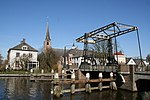
Hazerswoude-Rijndijk

Hazerswoude-Rijndijk is a Dutch village located in the province of South Holland. It is a part of the municipality of Alphen aan den Rijn, and lies about 5 km west of the village center. Hazerswoude-Rijndijk is a peat excavation settlement which developed in the Middle Ages south of the Oude Rijn.The Catholic St Bernardus Church is a single aisled church built between 1854 and 1855. The polder mill Groenendijkse Molen was built in 1627 as a wooden windmill. It was considered for replacement by a stone windmill several times. An electric pumping station was installed in 1959. In 1966, the windmill was bought by a foundation and restored to working order. It operates on a voluntary basis.
Excerpt from the Wikipedia article Hazerswoude-Rijndijk (License: CC BY-SA 3.0, Authors, Images).Hazerswoude-Rijndijk
Joseph Haydnlaan, Alphen aan den Rijn
Geographical coordinates (GPS) Address Website Nearby Places Show on map
Geographical coordinates (GPS)
| Latitude | Longitude |
|---|---|
| N 52.129166666667 ° | E 4.5930555555556 ° |
Address
De J.P.F. Steijaertschool
Joseph Haydnlaan
2394 ET Alphen aan den Rijn
South Holland, Netherlands
Open on Google Maps


