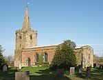
Twyford and Stenson is a civil parish in the South Derbyshire district of Derbyshire, England. Located south of Derby on the Trent and Mersey Canal, it consists of two villages, Stenson and its smaller neighbour Twyford.
Between Stenson and Derby itself lies the busy A50 dual-carriageway and Stenson Fields, a large housing estate built between the early 1970s and late 1990s. Stenson Fields is constituted as a separate parish wholly within South Derbyshire District, but it is essentially contiguous with the Sunny Hill, Sinfin and Littleover suburbs of Derby city. The parish of Stenson Fields was created in 1983 from parts of the parish of Barrow-upon-Trent and the parish of Twyford and Stenson. Originally called Sinfin Moor the name was later changed to Stenson Fields to be in keeping with the geographical and historical place name of the area. Sinfin Moor is a large tract of land to the east of Stenson Fields and Sinfin proper. Sinfin Moor is a Regionally Important Geological Site (RIGS) which formed over the bed of an ice age lake. Part of the RIGS spills over into Stenson Fields close to the hamlet of Arleston.
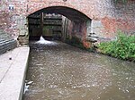
In 2017, South Derbyshire District Council described Twyford and Stenson as an "unparished area" when it approved the transfer of a further 197 acres from it to Stenson Fields parish. In 2020, Twyford and Stenson does not appear to have a parish council. Stenson Lock is lock number 6. It is the second deepest on the canal at 12' 6". There is also a marina and a narrowboat builders. The 'Stenson Bubble', after which the local waterside pub is named, is due to the sound, and actual bubbles, the overflow stream to the south of the lock makes as it emerges forcefully into the canal below the lock through a culvert at the same level, or sometimes below, the canal surface itself.
A railway line follows the line of the canal, part of a loop for freight bypassing Derby. This runs from the nearby Stenson Junction on the Derby-Birmingham line to Sheet Stores Junction at Sawley on the Midland Main Line.


