place

City of Derby Academy

Academies in DerbyEast Midlands school stubsSecondary schools in DerbyUse British English from February 2023

City of Derby Academy (formerly Sinfin Community School) is a mixed secondary school located in the Sinfin area of Derby in the English county of Derbyshire.Previously administered by Derby City Council, Sinfin Community School converted to academy status on 1 June 2013 and was renamed City of Derby Academy. The school is now part of QEGSMAT (Multi Academy Trust)City of Derby Academy offers GCSEs and vocational subjects as programmes of study for pupils.The school is smaller than the average-sized secondary school and has a capacity of 1050. The proportion of students whose first language is not English is nearly half, which is well above average. The proportion of students from ethnic minority backgrounds is also above half - Romany and Pakistani heritages being the largest. The building boasts excellent equipment, previously being a specialist technology school. There is also a large AstroTurf sports pitch, a large indoor sports hall, multiple tennis courts and a gymnasium.

Excerpt from the Wikipedia article City of Derby Academy (License: CC BY-SA 3.0, Authors).

City of Derby Academy
Farmhouse Road, Derby Sinfin

Geographical coordinates (GPS) Address Phone number Website External links Nearby Places
placeShow on map

Wikipedia: City of Derby AcademyContinue reading on Wikipedia

Geographical coordinates (GPS)

Latitude Longitude
N 52.8754 ° E -1.4918 °
placeShow on map

Address

City of Derby Academy

Farmhouse Road
DE24 3AR Derby, Sinfin
England, United Kingdom
mapOpen on Google Maps

Phone number

call+441332270450

Website
cityofderbyacademy.org

linkVisit website

linkWikiData (Q16890395)
linkOpenStreetMap (65292471)

Share experience

Nearby Places

Sinfin Central railway station

Sinfin Central station was in the city of Derby, Derbyshire, England. The station was on the former line between Derby and Ashby de la Zouch, which closed in 1930. On 4 October 1976 a new unstaffed passenger station was opened by British Rail to serve the nearby Rolls-Royce factory. Despite Derby City Council's efforts to encourage usage of public transport, based on the Cross-City Line in Birmingham, the service was very underused. The service was reduced to one return train per day in 1992, with the return departing Sinfin Central at 06:57. The service did not run at weekends, and there was no evening return. This ran until 1993, when the Derwent Valley Line, which interworked with the Sinfin branch, changed to using Sprinter trains. Sprinters were not permitted on the branch because of compatibility issues with the obsolete low-voltage track circuits used on the line. The last train ran on 17 May 1993, and the train service was replaced with a taxi. On 2 May 1997, the line became part of the Central Trains franchise as part of the privatisation of British Rail, but none of its trains ever stopped at the station. On 6 November 1997, Central Trains and the Director of Passenger Rail Franchising proposed the closure of the line. It was granted on 21 May 1998 by Rail Regulator John Swift QC. During the final year, there were three regular users of the taxi at a single fare of £1.20.Unlike Sinfin North, Sinfin Central had public access with a 360-yard (330 m) long footpath from Wilmore Road. However, gated barriers were installed in 2023, preventing non-Rolls-Royce employees from reaching the station. There was no public road access to the station or car park, and the path is still in situ. The line survives to serve the Rolls-Royce plant, and the station is still in situ.

Twyford and Stenson
Twyford and Stenson

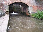
Twyford and Stenson is a civil parish in the South Derbyshire district of Derbyshire, England. Located south of Derby on the Trent and Mersey Canal, it consists of two villages, Stenson and its smaller neighbour Twyford. Between Stenson and Derby itself lies the busy A50 dual-carriageway and Stenson Fields, a large housing estate built between the early 1970s and late 1990s. Stenson Fields is constituted as a separate parish wholly within South Derbyshire District, but it is essentially contiguous with the Sunny Hill, Sinfin and Littleover suburbs of Derby city. The parish of Stenson Fields was created in 1983 from parts of the parish of Barrow-upon-Trent and the parish of Twyford and Stenson. Originally called Sinfin Moor the name was later changed to Stenson Fields to be in keeping with the geographical and historical place name of the area. Sinfin Moor is a large tract of land to the east of Stenson Fields and Sinfin proper. Sinfin Moor is a Regionally Important Geological Site (RIGS) which formed over the bed of an ice age lake. Part of the RIGS spills over into Stenson Fields close to the hamlet of Arleston. In 2017, South Derbyshire District Council described Twyford and Stenson as an "unparished area" when it approved the transfer of a further 197 acres from it to Stenson Fields parish. In 2020, Twyford and Stenson does not appear to have a parish council. Stenson Lock is lock number 6. It is the second deepest on the canal at 12' 6". There is also a marina and a narrowboat builders. The 'Stenson Bubble', after which the local waterside pub is named, is due to the sound, and actual bubbles, the overflow stream to the south of the lock makes as it emerges forcefully into the canal below the lock through a culvert at the same level, or sometimes below, the canal surface itself. A railway line follows the line of the canal, part of a loop for freight bypassing Derby. This runs from the nearby Stenson Junction on the Derby-Birmingham line to Sheet Stores Junction at Sawley on the Midland Main Line.