place

Twyford and Stenson

Civil parishes in DerbyshireOpenDomesdaySouth Derbyshire District
Stenson Bubble
Stenson Bubble

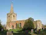
Twyford and Stenson is a civil parish in the South Derbyshire district of Derbyshire, England. Located south of Derby on the Trent and Mersey Canal, it consists of two villages, Stenson and its smaller neighbour Twyford. Between Stenson and Derby itself lies the busy A50 dual-carriageway and Stenson Fields, a large housing estate built between the early 1970s and late 1990s. Stenson Fields is constituted as a separate parish wholly within South Derbyshire District, but it is essentially contiguous with the Sunny Hill, Sinfin and Littleover suburbs of Derby city. The parish of Stenson Fields was created in 1983 from parts of the parish of Barrow-upon-Trent and the parish of Twyford and Stenson. Originally called Sinfin Moor the name was later changed to Stenson Fields to be in keeping with the geographical and historical place name of the area. Sinfin Moor is a large tract of land to the east of Stenson Fields and Sinfin proper. Sinfin Moor is a Regionally Important Geological Site (RIGS) which formed over the bed of an ice age lake. Part of the RIGS spills over into Stenson Fields close to the hamlet of Arleston. In 2017, South Derbyshire District Council described Twyford and Stenson as an "unparished area" when it approved the transfer of a further 197 acres from it to Stenson Fields parish. In 2020, Twyford and Stenson does not appear to have a parish council. Stenson Lock is lock number 6. It is the second deepest on the canal at 12' 6". There is also a marina and a narrowboat builders. The 'Stenson Bubble', after which the local waterside pub is named, is due to the sound, and actual bubbles, the overflow stream to the south of the lock makes as it emerges forcefully into the canal below the lock through a culvert at the same level, or sometimes below, the canal surface itself. A railway line follows the line of the canal, part of a loop for freight bypassing Derby. This runs from the nearby Stenson Junction on the Derby-Birmingham line to Sheet Stores Junction at Sawley on the Midland Main Line.

Excerpt from the Wikipedia article Twyford and Stenson (License: CC BY-SA 3.0, Authors, Images).

Twyford and Stenson
Stenson Road, South Derbyshire

Geographical coordinates (GPS) Address Nearby Places
placeShow on map

Wikipedia: Twyford and StensonContinue reading on Wikipedia

Geographical coordinates (GPS)

Latitude Longitude
N 52.866 ° E -1.517 °
placeShow on map

Address

Stenson Road

Stenson Road
DE73 7HL South Derbyshire
England, United Kingdom
mapOpen on Google Maps

Stenson Bubble
Stenson Bubble
Share experience

Nearby Places

Findern
Findern

Findern is a village and civil parish in the District of South Derbyshire, approximately 5–6 miles (9.7 km) south of Derby (Grid reference: SK309307). The population of the civil parish was 1,669 at the 2011 Census.Findern is a picturesque and quaint little village full of charm and character, with many of its buildings being of both historical and architectural importance. Its traditional Old English village green is overlooked by the All Saints' parish church, and is surrounded by a handful of shops, and numerous black and white painted nineteenth century cottages that include The Old Forge, a former farm and blacksmith's shop. The village green plays host to an annual fete and the cottages were originally part of a weaving industry that peaked in 1846, when 22 velvet and silk looms existed, with each dwelling containing its own loom. A row of period buildings continue out onto Main Street with the oldest being from 1620. Somerville House, with its high gateway that allowed carriages to pass under it, was originally a gentleman's residence that was built in the mid 18th century. Its porch, wall and railings were added in the 19th century. Wallfield House on Doles Lane was constructed in 1822 as a farm, and in the 20th century became the home of racing driver and Aston Martin team manager Reg Parnell. He competed in the inaugural Formula One World Championship Grand Prix at Silverstone in 1950, and in 1959 won both Le Mans and the World Sports Car Championship. Parnell eventually came to live – and farm – at Wallfield House, which is now a residential home, that bares a blue plaque in his memory. Castle Hill, which previously led to a long since demolished manor house, boasts a village pump, that was used by the entire community until 1931, when mains water finally came to the village. Well Dressing is a long held village tradition. At the top of Hillside stands Tower House which was originally a windmill, built in 1715. It was converted into a private dwelling in 1914 and was the home of Edwina Currie when she was MP for South Derbyshire from the 1980's onwards. It is claimed that on a clear day 22 churches including Lichfield Cathedral can be seen from the mill. Mercia Marina opened in September 2008 in the 24-acre Willington Lake, surrounded by another 50 acres (0.20 km2) of countryside for dog-walking fields, a wildlife lake and a holiday home development. In building the marina, twelve islands or promontories were added to the natural contours of the lake thus creating a green oasis for people and wildlife alike. This was enhanced by a £85,000 planting scheme, featuring wildflower banks, reed beds, semi mature trees and native plants. For boaters, the layout of Mercia Marina is akin to a series of small marinas joined by wide expanses of open water. The area includes numerous shops, a bar, coffee house and tea rooms. Findern Primary School on Heath Lane was designed by the pioneering architect George Henry Widdows and constructed in 1924. The highly popular Dobbies Garden Centre is to be found on Doles Lane. The canal at Findern, forms part of the Trent and Mersey Canal, which was completed in 1777, and connects the to more than 70 locks and five tunnels, ultimately joining the River Trent to the River Mersey. The railway line runs alongside the canal and was opened by the Birmingham and Derby Junction Railway on its original route from Derby to Hampton-in-Arden where it met the London and Birmingham Railway for London. The village is nowadays bounded on two sides by major A roads; the A38 and the A50. The former, to the north east, follows the course of the Roman road Icknield Street, while the latter passes to the south of the village centre and runs parallel to the canal. In contrast to the ancient route of the A38, the A50 road was laid only in 1997.