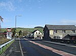
Hen Gaer
Hillforts in CeredigionScheduled monuments in Wales

Hen Gaer is an Iron Age hillfort, on a hill adjacent to and east of Bow Street, Ceredigion, Wales. Other names of the hillfort are Broncastellan and Caer Shon.
Excerpt from the Wikipedia article Hen Gaer (License: CC BY-SA 3.0, Authors, Images).Hen Gaer
Gogerddan Trail,
Geographical coordinates (GPS) Address External links Nearby Places Show on map
Geographical coordinates (GPS)
| Latitude | Longitude |
|---|---|
| N 52.4403 ° | E -4.0127 ° |
Address
Hen Gaer
Gogerddan Trail
SY23 3EB , Tirymynach
Wales, United Kingdom
Open on Google Maps


