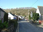
Rhydypennau, Ceredigion
Villages in Ceredigion

Rhydypennau is a hamlet in the Genau'r-glyn district of Ceredigion, Wales, approximately 4+1⁄2 miles (7.2 km) north-east of Aberystwyth. Along with the village of Pen-y-garn, Rhydypennau is now often considered to be part of the neighbouring village of Bow Street. All three places stretch in a long narrow strip along the main Aberystwyth to Machynlleth road (A487).
Excerpt from the Wikipedia article Rhydypennau, Ceredigion (License: CC BY-SA 3.0, Authors, Images).Rhydypennau, Ceredigion
B4353,
Geographical coordinates (GPS) Address Nearby Places Show on map
Geographical coordinates (GPS)
| Latitude | Longitude |
|---|---|
| N 52.453889 ° | E -4.019722 ° |
Address
B4353
SY24 5BT , Geneu'r Glyn
Wales, United Kingdom
Open on Google Maps


