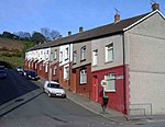
Tonyrefail
AC with 0 elementsCommunities in Rhondda Cynon TafVillages in Rhondda Cynon Taf

Tonyrefail is a village and community in the Rhondda Cynon Taf County Borough, Wales. It is situated at the head of the River Ely; 4 miles (6.4 km) northwest of Llantrisant, about 1.5 miles (2.4 km) from Trebanog and about 2 miles (3.2 km) from Williamstown. During the second half of the 19th century, when coal and steel became synonymous with the South Wales Valleys, Tonyrefail evolved from being a rural hamlet to an industrial village. The population at the 2001 census was 11,035.
Excerpt from the Wikipedia article Tonyrefail (License: CC BY-SA 3.0, Authors, Images).Tonyrefail
Waunrhydd Road,
Geographical coordinates (GPS) Address Nearby Places Show on map
Geographical coordinates (GPS)
| Latitude | Longitude |
|---|---|
| N 51.583973 ° | E -3.430554 ° |
Address
Waunrhydd Road
Waunrhydd Road
CF39 8EN , Tonyrefail
Wales, United Kingdom
Open on Google Maps


