place

Sompting Abbotts Preparatory School

1921 establishments in EnglandEducational institutions established in 1921Preparatory schools in West SussexUse British English from February 2023
Sompting Abbotts logo

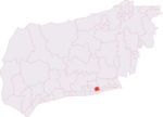
Sompting Abbotts Preparatory School is a historic West Sussex independent school in Sompting, near Worthing and Steyning. It educates children of both sexes aged 2 to 13. The school sits in parkland of 30 acres, which includes woodland, chalk grassland slopes and a pond.The school was founded in 1921 and is a member of the Independent Association of Preparatory Schools (IAPS) and it is a non-selective day school. The headmaster is Chris Gunn and the principal is Patricia Sinclair. The school has strong links with the Church of St Mary the Blessed Virgin and holds its annual Harvest Festival and Christmas carol services there.

Excerpt from the Wikipedia article Sompting Abbotts Preparatory School (License: CC BY-SA 3.0, Authors, Images).

Sompting Abbotts Preparatory School
Church Lane, Adur

Geographical coordinates (GPS) Address Phone number Website External links Nearby Places
placeShow on map

Wikipedia: Sompting Abbotts Preparatory SchoolContinue reading on Wikipedia

Geographical coordinates (GPS)

Latitude Longitude
N 50.83959 ° E -0.3499 °
placeShow on map

Address

Sompting Abbotts Preparatory School

Church Lane
BN15 0AZ Adur
England, United Kingdom
mapOpen on Google Maps

Phone number

call+441903235960

Website
somptingabbotts.com

linkVisit website

linkWikiData (Q42309941)
linkOpenStreetMap (168319220)

Sompting Abbotts logo
Share experience

Nearby Places

Brighton and Hove built-up area

The Brighton and Hove Built-up area or Brighton/Worthing/Littlehampton conurbation has a population of 474,485 (2011 census), making it England's 12th largest conurbation. This was an increase of around 3% from the 2001 population of 461,181. Named the Brighton/Worthing/Littlehampton conurbation by the Office for National Statistics for the 2001 census and Brighton and Hove Built-up area for the 2011 census, the area has also been known as Greater Brighton, although the Greater Brighton City Region that was created in 2014 from seven local authorities in Sussex covers a much larger area. The conurbation dominates West and East Sussex, with around one in three of Sussex's population living within its boundaries. It is also the second largest conurbation in the South East region of England and the second largest conurbation on the English Channel coast, in either England or France. In both of these cases the Brighton conurbation trails the Southampton and Portsmouth conurbation. The Brighton/Worthing/Littlehampton conurbation was the largest on the Channel before Portsmouth and Southampton's conurbations were combined for much official data analysis after the 2011 census. This conurbation is also the UK's most densely populated major conurbation outside London with 5,304 inhabitants per square kilometre (13,740/sq mi). This is due to its tight boundaries between the South Downs national park to the north, and the English Channel to the south together with less land devoted to domestic gardens in English seaside towns than in inland towns. It is a multi-centred conurbation and the eastern part, the city of Brighton and Hove, has approximately half of its population.