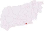
place

Church of St Mary the Blessed Virgin, Sompting

11th-century church buildings in EnglandAdur DistrictChurch of England church buildings in West SussexGrade I listed churches in West SussexStanding Anglo-Saxon churches
St Mary the Blessed Virgin Church, Sompting (from Geograph 1194036 39eae17f)

The Church of St Mary the Blessed Virgin, also known as St Mary the Virgin Church and St Mary's Church, is the Church of England parish church of Sompting in the Adur district of West Sussex. It stands on a rural lane north of the urban area that now surrounds the village, and retains much 11th- and 12th-century structure. Its most important architectural feature is the Saxon tower topped by a Rhenish helm, a four-sided pyramid-style gabled cap that is uncommon in England. English Heritage lists the church at Grade I for its architecture and history.

Excerpt from the Wikipedia article Church of St Mary the Blessed Virgin, Sompting (License: CC BY-SA 3.0, Authors, Images).

Church of St Mary the Blessed Virgin, Sompting
Church Lane, Adur

Geographical coordinates (GPS) Address External links Nearby Places
placeShow on map

Wikipedia: Church of St Mary the Blessed Virgin, SomptingContinue reading on Wikipedia

Geographical coordinates (GPS)

Latitude Longitude
N 50.8386 ° E -0.3518 °
placeShow on map

Address

Saint Mary's

Church Lane
BN15 0BA Adur
England, United Kingdom
mapOpen on Google Maps

linkWikiData (Q5117574)
linkOpenStreetMap (493006048)

St Mary the Blessed Virgin Church, Sompting (from Geograph 1194036 39eae17f)
Share experience

Nearby Places

Brighton and Hove built-up area

The Brighton and Hove Built-up area or Brighton/Worthing/Littlehampton conurbation has a population of 474,485 (2011 census), making it England's 12th largest conurbation. This was an increase of around 3% from the 2001 population of 461,181. Named the Brighton/Worthing/Littlehampton conurbation by the Office for National Statistics for the 2001 census and Brighton and Hove Built-up area for the 2011 census, the area has also been known as Greater Brighton, although the Greater Brighton City Region that was created in 2014 from seven local authorities in Sussex covers a much larger area. The conurbation dominates West and East Sussex, with around one in three of Sussex's population living within its boundaries. It is also the second largest conurbation in the South East region of England and the second largest conurbation on the English Channel coast, in either England or France. In both of these cases the Brighton conurbation trails the Southampton and Portsmouth conurbation. The Brighton/Worthing/Littlehampton conurbation was the largest on the Channel before Portsmouth and Southampton's conurbations were combined for much official data analysis after the 2011 census. This conurbation is also the UK's most densely populated major conurbation outside London with 5,304 inhabitants per square kilometre (13,740/sq mi). This is due to its tight boundaries between the South Downs national park to the north, and the English Channel to the south together with less land devoted to domestic gardens in English seaside towns than in inland towns. It is a multi-centred conurbation and the eastern part, the city of Brighton and Hove, has approximately half of its population.