place

Worthing East (electoral division)

Electoral Divisions of West SussexUnited Kingdom electoral ward stubsWorthing
Worthing East (electoral division)

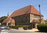
Worthing East is an electoral division of West Sussex in the United Kingdom, and returns one member to sit on West Sussex County Council.

Excerpt from the Wikipedia article Worthing East (electoral division) (License: CC BY-SA 3.0, Authors, Images).

Worthing East (electoral division)
Lyndhurst Road,

Geographical coordinates (GPS) Address Nearby Places
placeShow on map

Wikipedia: Worthing East (electoral division)Continue reading on Wikipedia

Geographical coordinates (GPS)

Latitude Longitude
N 50.817 ° E -0.35225 °
placeShow on map

Address

Lyndhurst Road

Lyndhurst Road
BN11 2DW , Broadwater
England, United Kingdom
mapOpen on Google Maps

Worthing East (electoral division)
Share experience

Nearby Places

Brighton and Hove built-up area

The Brighton and Hove Built-up area or Brighton/Worthing/Littlehampton conurbation has a population of 474,485 (2011 census), making it England's 12th largest conurbation. This was an increase of around 3% from the 2001 population of 461,181. Named the Brighton/Worthing/Littlehampton conurbation by the Office for National Statistics for the 2001 census and Brighton and Hove Built-up area for the 2011 census, the area has also been known as Greater Brighton, although the Greater Brighton City Region that was created in 2014 from seven local authorities in Sussex covers a much larger area. The conurbation dominates West and East Sussex, with around one in three of Sussex's population living within its boundaries. It is also the second largest conurbation in the South East region of England and the second largest conurbation on the English Channel coast, in either England or France. In both of these cases the Brighton conurbation trails the Southampton and Portsmouth conurbation. The Brighton/Worthing/Littlehampton conurbation was the largest on the Channel before Portsmouth and Southampton's conurbations were combined for much official data analysis after the 2011 census. This conurbation is also the UK's most densely populated major conurbation outside London with 5,304 inhabitants per square kilometre (13,740/sq mi). This is due to its tight boundaries between the South Downs national park to the north, and the English Channel to the south together with less land devoted to domestic gardens in English seaside towns than in inland towns. It is a multi-centred conurbation and the eastern part, the city of Brighton and Hove, has approximately half of its population.