Charlbury
CharlburyCivil parishes in OxfordshireCotswoldsEngvarB from May 2016Pages with plain IPA ... and 2 more
Towns in OxfordshireWest Oxfordshire District

Charlbury () is a town and civil parish in the Evenlode valley, about 6 miles (10 km) north of Witney in the West Oxfordshire district of Oxfordshire, England. It is on the edge of Wychwood Forest and the Cotswolds. The 2011 Census recorded the parish's population as 2,830.
Excerpt from the Wikipedia article Charlbury (License: CC BY-SA 3.0, Authors, Images).Charlbury
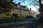
Sheep Street, West Oxfordshire Charlbury
Geographical coordinates (GPS) Address Nearby Places Show on map
Geographical coordinates (GPS)
| Latitude | Longitude |
|---|---|
| N 51.872 ° | E -1.482 ° |
Address
Sheep Street
OX7 3RR West Oxfordshire, Charlbury
England, United Kingdom
Open on Google Maps


