Cornbury and Wychwood
Civil parishes in OxfordshireOxfordshire geography stubsWest Oxfordshire District
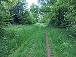
Cornbury and Wychwood is a civil parish in West Oxfordshire. It includes the country estate of Cornbury Park (Ordnance Survey grid reference SP350181) and the ancient former Royal Forest of Wychwood, which covers several square miles between Cornbury Park, the village of Leafield (grid reference SP3215) and the hamlet of Mount Skippett (SP352159).
Excerpt from the Wikipedia article Cornbury and Wychwood (License: CC BY-SA 3.0, Authors).Cornbury and Wychwood
Stonesfield Lane, West Oxfordshire
Geographical coordinates (GPS) Address Nearby Places Show on map
Geographical coordinates (GPS)
| Latitude | Longitude |
|---|---|
| N 51.859 ° | E -1.458 ° |
Address
Stonesfield Lane
Stonesfield Lane
OX7 3ER West Oxfordshire
England, United Kingdom
Open on Google Maps


