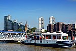
Sands End
Areas of LondonDistricts of London on the River ThamesDistricts of the London Borough of Hammersmith and FulhamFulhamHistory of the London Borough of Hammersmith and Fulham ... and 1 more
Use British English from September 2015
Sands End is an area of the ancient parish of Fulham, formerly in the County of Middlesex, which is now the southernmost part of the London Borough of Hammersmith and Fulham, England. In a deep loop of the River Thames, between the tidal Chelsea Creek and the old Peterborough estate, west of Wandsworth Bridge, its northern edge is New King's Road. While wharves, industrial acres and workers' cottages gave way to intensive re-development such as Chelsea Harbour and Imperial Wharf in the last quarter of the 20th-century, it still contains some 300-year-old cottages and 19th century streets.
Excerpt from the Wikipedia article Sands End (License: CC BY-SA 3.0, Authors).Sands End
Albion Quay, London Battersea (London Borough of Wandsworth)
Geographical coordinates (GPS) Address Nearby Places Show on map
Geographical coordinates (GPS)
| Latitude | Longitude |
|---|---|
| N 51.473 ° | E -0.18 ° |
Address
Battersea Railway Bridge (Cremorne Bridge)
Albion Quay
SW11 3RQ London, Battersea (London Borough of Wandsworth)
England, United Kingdom
Open on Google Maps


