Counter's Creek
AC with 0 elementsCanals in EnglandCanals in LondonCanals opened in 1828History of the London Borough of Hammersmith and Fulham ... and 4 more
Rivers of LondonSubterranean rivers of LondonThames drainage basinUse British English from December 2012

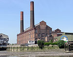
Counter's Creek, ending in Chelsea Creek, the lowest part of which still exists, was a stream that flowed from Kensal Green, by North Kensington and flowed south into the River Thames on the Tideway at Sands End, Fulham. Its remaining open watercourse is the quay of Chelsea Creek.
Excerpt from the Wikipedia article Counter's Creek (License: CC BY-SA 3.0, Authors, Images).Counter's Creek
The Towpath, London Sands End (London Borough of Hammersmith and Fulham)
Geographical coordinates (GPS) Address Nearby Places Show on map
Geographical coordinates (GPS)
| Latitude | Longitude |
|---|---|
| N 51.474722222222 ° | E -0.18027777777778 ° |
Address
The Belvedere
The Towpath
SW10 0XA London, Sands End (London Borough of Hammersmith and Fulham)
England, United Kingdom
Open on Google Maps


