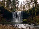
place

Alston, Oregon

Portland metropolitan area geography stubsUnincorporated communities in Columbia County, OregonUnincorporated communities in OregonUse mdy dates from July 2023
Wu Alston
Wu Alston

Alston is an unincorporated community in Columbia County in the U.S. state of Oregon. It lies along U.S. Route 30 (Lower Columbia River Highway) between Rainier and Clatskanie. Old Rainier Road and Alston–Mayger Road intersect Route 30 at Alston.

Excerpt from the Wikipedia article Alston, Oregon (License: CC BY-SA 3.0, Authors, Images).

Alston, Oregon
Wonderly Road,

Geographical coordinates (GPS) Address Nearby Places
placeShow on map

Wikipedia: Alston, OregonContinue reading on Wikipedia

Geographical coordinates (GPS)

Latitude Longitude
N 46.099166666667 ° E -123.04694444444 °
placeShow on map

Address

Wonderly Road 25259
97048
Oregon, United States
mapOpen on Google Maps

Wu Alston
Wu Alston
Share experience

Nearby Places

Apiary, Oregon
Apiary, Oregon

Apiary is an unincorporated community in Columbia County, Oregon, United States, that takes its name from a post office established by David M. Dorsey. The post office operated from August 28, 1889, until March 24, 1924. It is reported that Dorsey was a beekeeper, which provided the source of the name for the Post Office and thus the community. The community was served by Apiary School District #38, which operated a two-room school providing education services for grades 1 through 8. When operational, it operated in conjunction with the Rainier Union High School District which provided education services for grades 9 through 12. (The high school district also included a number of other grade school districts in the area: Delena, Hudson, Fern Hill, Rainier, Goble, Shiloh Basin, and Neer City districts. In the 1960s, the districts were consolidated into a single district, and the rural schools were closed over the next 10 to 15 years.) The community and the school are located along the road now known as Apiary Road near the headwaters of the North Fork of the Clatskanie River. At this writing, the school building still exists but has been converted to a private home. The community also includes a pioneer cemetery but has never contained a community center such as a church, Grange hall, or even a fire station. Currently, Apiary Road is a popular freight route for forest products moving from the Northern Oregon Coast Range (particularly areas drained by the Nehalem River) to markets in Longview, Washington. The Apiary Road interconnects the Nehalem Highway north of Pittsburg signed as Oregon Route 47 with U.S. Route 30 west of Rainier. However, the intersection with U.S. Route 30 is signed as Larson Road, because Apiary Road technically ends at Old Rainier Road, a former route of U.S. Route 30 just to the south of the present U.S. Route 30.
Lewis and Clark Bridge (Columbia River)

The Lewis and Clark Bridge is a cantilever bridge that spans the Columbia River between Longview, Washington, and Rainier, Oregon. At the time of its completion, it had the longest cantilever span in the United States. The bridge was opened on March 29, 1930, as a privately owned bridge named the Longview Bridge. The $5.8 million cost (equivalent to $81 million in 2022 dollars) was recovered by tolls, $1.00 for cars and $0.10 for pedestrians (equivalent to $14.01 for cars and $1.4 for pedestrians in 2022 dollars). At the time it was the longest and highest cantilever bridge in the United States. The state of Washington purchased the bridge in 1947 and the tolls were removed in 1965 after the bridge was paid for. In 1980, the bridge was rededicated as the Lewis and Clark Bridge in honor of the Lewis and Clark Expedition. The deck was replaced in 2003–04 at a cost of $29.2 million. The bridge is 2,722 ft (830 m) long with 210 ft (64 m) of vertical clearance. The main span is 1,200 ft (366 m) long and the top of the bridge is 340 ft (104 m) above the river. It was designed by Joseph Strauss, the engineer of the Golden Gate Bridge. In 1982, the bridge was entered on the National Register of Historic Places, as the Longview Bridge. A feasibility study commissioned by the Washington State Legislature in 1990 recommended the construction of a second bridge to handle future traffic volume. The Lewis and Clark Bridge was closed for four days in July 2023 to replace a floor beam and install new finger joints; during the closure, which was originally scheduled for eight days, the Wahkiakum County Ferry was used as a detour route for prioritized traffic.