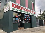
Red Hook, Brooklyn

Red Hook is a neighborhood in northwestern Brooklyn, New York City, New York, within the area once known as South Brooklyn. It is located on a peninsula projecting into the Upper New York Bay and is bounded by the Gowanus Expressway and the Carroll Gardens neighborhood on the northeast, Gowanus Canal on the east, and the Upper New York Bay on the west and south. A prosperous shipping and port area in the early 20th century, the area declined in the latter part of the century. Today it is home to the Red Hook Houses, the largest housing project in Brooklyn. Red Hook is part of Brooklyn Community District 6, and its primary ZIP Code is 11231. It is patrolled by the 76th Precinct of the New York City Police Department. Politically, Red Hook is represented by the New York City Council's 38th District.
Excerpt from the Wikipedia article Red Hook, Brooklyn (License: CC BY-SA 3.0, Authors, Images).Red Hook, Brooklyn
Sullivan Street, New York Brooklyn
Geographical coordinates (GPS) Address Nearby Places Show on map
Geographical coordinates (GPS)
| Latitude | Longitude |
|---|---|
| N 40.677 ° | E -74.011 ° |
Address
Sullivan Street 46
11231 New York, Brooklyn
New York, United States
Open on Google Maps


