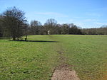
Locksbottom
Areas of LondonDistricts of the London Borough of BromleyLondon geography stubsUse British English from September 2015

Locksbottom is a suburb of south-east London within the London Borough of Bromley and the historic county of Kent. It is located south of Bromley Common, west of Crofton, north-west of Farnborough, and east of Keston.
Excerpt from the Wikipedia article Locksbottom (License: CC BY-SA 3.0, Authors, Images).Locksbottom
Munnery Way, London Locksbottom (London Borough of Bromley)
Geographical coordinates (GPS) Address Nearby Places Show on map
Geographical coordinates (GPS)
| Latitude | Longitude |
|---|---|
| N 51.3708 ° | E 0.0608 ° |
Address
Munnery Way
Munnery Way
BR6 8QD London, Locksbottom (London Borough of Bromley)
England, United Kingdom
Open on Google Maps


