Petts Wood
Areas of LondonDistricts of the London Borough of BromleyForests and woodlands of LondonUse British English from September 2015

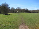
Petts Wood is a town in south-east London, England, previously located in the historic county of Kent. It lies south of Chislehurst, west of St Paul's Cray and Poverest, north of Orpington and Crofton, and east of Southborough and Bromley Common. The area forms part of the London Borough of Bromley local authority district in the ceremonial county of Greater London.
Excerpt from the Wikipedia article Petts Wood (License: CC BY-SA 3.0, Authors, Images).Petts Wood
Fairway, London Petts Wood (London Borough of Bromley)
Geographical coordinates (GPS) Address Nearby Places Show on map
Geographical coordinates (GPS)
| Latitude | Longitude |
|---|---|
| N 51.3885 ° | E 0.076 ° |
Address
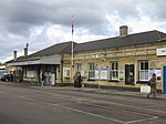
Petts Wood Station Car Park
Fairway
BR5 1EQ London, Petts Wood (London Borough of Bromley)
England, United Kingdom
Open on Google Maps


