Ramat David Airbase
Airfields of the United States Army Air ForcesAll accuracy disputesIsraeli Air Force basesMilitary units and formations established in 1942Military units and formations established in 1948 ... and 1 more
World War II airfields in Mandatory Palestine

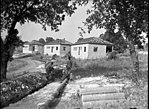
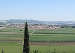
Ramat David Airbase (ICAO: LLRD, Hebrew: בָּסִיס חֵיל-הַאֲוִיר רָמַת דָּוִד Basis Kheil HaAvir Ramat David, English: David Heights) is an Israeli Air Force (IAF) base located 20 km southeast of Haifa in the Northern District of Israel, close to kibbutz Ramat David in the Jezreel Valley. It is the northernmost IAF base in Israel with fighter jets, UAVs and helicopters based on it.
Excerpt from the Wikipedia article Ramat David Airbase (License: CC BY-SA 3.0, Authors, Images).Ramat David Airbase
דרך המוביל, Emek Izrael Regional Council
Geographical coordinates (GPS) Address External links Nearby Places Show on map
Geographical coordinates (GPS)
| Latitude | Longitude |
|---|---|
| N 32.666666666667 ° | E 35.183333333333 ° |
Address
בסיס חיל האויר רמת דוד
דרך המוביל
Emek Izrael Regional Council
North District, Israel
Open on Google Maps


