place

Oxborough

Breckland DistrictCivil parishes in NorfolkNorfolk geography stubsVillages in Norfolk
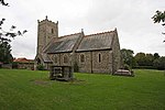
OxboroughChurch(JohnSalmon)Oct2004

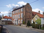
Oxborough is a village and civil parish in the English county of Norfolk, well known for its church and manor house Oxburgh Hall. It covers an area of 13.024 km2 (5.029 sq mi) and had a population of 240 in 106 households in the 2001 census, reducing to a population of 228 in 111 households at the 2011 Census. For the purposes of local government, it falls within the district of Breckland. The villages name means 'Ox fortification’. The Oxborough dirk, a Bronze Age ceremonial oversize dagger was discovered nearby in 1988. It was acquired for the nation and is now on display in the British Museum.

Excerpt from the Wikipedia article Oxborough (License: CC BY-SA 3.0, Authors, Images).

Oxborough
Oxborough Road, Breckland District Oxborough

Geographical coordinates (GPS) Address Nearby Places
placeShow on map

Wikipedia: OxboroughContinue reading on Wikipedia

Geographical coordinates (GPS)

Latitude Longitude
N 52.5814 ° E 0.5708 °
placeShow on map

Address

Parterre

Oxborough Road
PE33 9PS Breckland District, Oxborough
England, United Kingdom
mapOpen on Google Maps

OxboroughChurch(JohnSalmon)Oct2004
Share experience

Nearby Places

Northwold
Northwold

Northwold ("North forest") is a village and civil parish in the English county of Norfolk. It covers an area of 19.72 km2 (7.61 sq mi) and had a population of 1,070 in 448 households at the 2001 census, increasing to 1,085 at the 2011 Census. For the purposes of local government, it falls within the district of King's Lynn and West Norfolk. The civil parish also includes the hamlets of Whittington and Little London. The village is 7.5 mi (12.1 km) north of Brandon which is also the closest railway station on the Thetford to Ely line, and 95 mi (153 km) from London. It lies just to the north of the A134 between Thetford and King's Lynn and on the river Wissey, in the Western division of the county, Grimshoe Hundred, Thetford union and county court district, Cranwich rural deanery, Norfolk archdeaconry and Norwich Diocese. Northwold is mentioned in the Domesday Book and traces of human and mole settlements from the Neolithic period have been recorded. Hugh of Northwold was Abbot of Bury St Edmunds from 1215 to 1229 and afterwards Bishop of Ely. Between 1279 and 1301 John of Northwold was Abbot of Bury St Edmunds. Northwold is surrounded by farmland and some of the inhabitants work on farms in the district. This area of England cultivates sugar beet and there are several factories producing sugar in the region. Residents not working locally commute to Norwich or the nearby towns such as King's Lynn, Swaffham, Downham Market.The Norman Church of England Primary School (formerly The Norman School) is the only school in the village. It is named after local benefactor Caroline Amelia Norman. Northwold has not got a general store or post office. In earlier times the village boasted several public houses but now (2021) has one remaining pub "The Crown Inn". but at the current time (2023) the pub is closed due to the owners ill health.The village is served by the number 88 bus six times a day (Mon-Fri), running between Thetford and Kings Lynn. There is a reduced service of 3 buses a day on Saturdays.