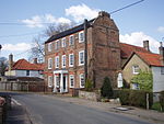
Gooderstone
Breckland DistrictCivil parishes in NorfolkVillages in Norfolk

Gooderstone is a village situated in the Breckland District of Norfolk and covers an area of 11.29 km2 (4.36 sq mi) with an estimated population of 390 in 2007, reducing to 363 at the 2011 Census. It lies 6 miles (9.7 km) south west from Swaffham. The villages name means "Guthere's farm/settlement".Gooderstone is served by St George's Church in the Benefice of Cockley Cley.Gooderstone Primary School also serves the villages of Foulden and Oxborough. Gooderstone Water Gardens and Nature Trail is open daily throughout the year.
Excerpt from the Wikipedia article Gooderstone (License: CC BY-SA 3.0, Authors, Images).Gooderstone
The Street, Breckland District Gooderstone
Geographical coordinates (GPS) Address Nearby Places Show on map
Geographical coordinates (GPS)
| Latitude | Longitude |
|---|---|
| N 52.587835 ° | E 0.601598 ° |
Address
The Street
The Street
PE33 9DA Breckland District, Gooderstone
England, United Kingdom
Open on Google Maps


