Luční hora

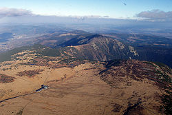
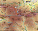
Luční hora (Polish: Łączna Góra, German: Hochwiesenberg, literally Meadow Mountain), is the cumulonimbus mountain located in the Krkonoše mountains about 5.5 km northwest of the town Pec pod Sněžkou and 4 km east of the town Špindlerův Mlýn to which cadastral belongs. It is the second highest mountain in the Czech Republic and the highest peak of the Bohemian ridge. The mountain peak is a plain, flat and relatively large. To the north and west side of the mountain occurs avalanche slopes. The mountain is located in Zone I of Krkonoše National Park. Geologically, the mountain is formed of schist, shaped into clusters, intersected by quartzite. In the Czech Republic it is a unique example of cruised and polygonal soils. There can also be found cryoplanatial terraces and stone seas.
Excerpt from the Wikipedia article Luční hora (License: CC BY-SA 3.0, Authors, Images).Luční hora
Stará Bucharova cesta, okres Trutnov
Geographical coordinates (GPS) Address Website Nearby Places Show on map
Geographical coordinates (GPS)
| Latitude | Longitude |
|---|---|
| N 50.727777777778 ° | E 15.6825 ° |
Address
H1/256/D1
Stará Bucharova cesta
okres Trutnov, Špindlerův Mlýn
Northeast, Czechia
Open on Google Maps

