place

Darum/Gretesch/Lüstringen

Geography of Osnabrück

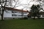
Darum/Gretesch/Lüstringen is a district of the city of Osnabrück, Lower Saxony, Germany. It is situated in the east of the city and is made up of these three localities, as well as land from within the former boundaries of Schinkel. It is home to a Protestant and a Catholic church – respectively the Petruskirche (St. Peter’s Church) and the Marienkirche (St. Mary’s Church). There also used to be a railway station in this district – Osnabrück-Lüstringen, which was located on the Osnabrück–Hannover line and operated until 1978. The district is situated on the Route of Megalithic Culture.

Excerpt from the Wikipedia article Darum/Gretesch/Lüstringen (License: CC BY-SA 3.0, Authors).

Darum/Gretesch/Lüstringen
Mindener Straße, Osnabrück Lüstringen

Geographical coordinates (GPS) Address Nearby Places
placeShow on map

Wikipedia: Darum/Gretesch/LüstringenContinue reading on Wikipedia

Geographical coordinates (GPS)

Latitude Longitude
N 52.2675 ° E 8.1306 °
placeShow on map

Address

Auf dem Winkel

Mindener Straße
49086 Osnabrück, Lüstringen
Lower Saxony, Germany
mapOpen on Google Maps

Share experience

Nearby Places

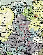
Prince-Bishopric of Osnabrück

The Prince-Bishopric of Osnabrück) (German: Hochstift Osnabrück; Fürstbistum Osnabrück, Bistum Osnabrück) was an ecclesiastical principality of the Holy Roman Empire from 1225 until 1803. It should not be confused with the Diocese of Osnabrück (German: Bistum Osnabrück), which was larger and over which the prince-bishop exercised only the spiritual authority of an ordinary bishop. It was named after its capital, Osnabrück. The still-extant Diocese of Osnabrück, erected in 772, is the oldest see founded by Charlemagne, in order to Christianize the conquered stem-duchy of Saxony. The episcopal and capitular temporal possessions of the see, originally quite limited, grew in time, and its prince-bishops exercised an extensive civil jurisdiction within the territory covered by their rights of Imperial immunity. The Prince-Bishopric continued to grow in size, making its status during the Reformation a highly contentious issue. The Peace of Westphalia left the city bi-confessional and had the Prince-Bishops alternate between Catholic and Protestant. The bishopric was dissolved in the German Mediatisation of 1803, when it was incorporated into the neighboring Electorate of Hanover. The see, the chapter, the convents and the Catholic charitable institutions were secularized. The territory of the see passed to Prussia in 1806, to the Kingdom of Westphalia in 1807, to Napoleonic France in 1810, and back to Hanover in 1814. With the end of the prince-bishopric, the future of the diocese became unclear. Klemens von Gruben, titular Bishop of Paros in Greece, was made vicar apostolic of Osnabrück, and as such cared for the spiritual interests of the Catholic population. The ordinary Latin (Roman) Catholic episcopacy was restored in 1824, but henceforth the bishops would no longer wield any temporal power.

Widukindland
Widukindland

Widukindland is a district of Osnabrück, Germany. It is situated in the north-east of the city, on the slopes of the Schinkelberg (Schinkel Hill). It arose from the former boundaries of Schinkel. The Freiheitsweg (Freedom Way) and the Heimatweg (Homeland Way) were built in 1922. This settlement north of Bremer Straße was transformed under Nazi rule in the 1930s into a small housing estate area. The zeitgeist of that era remains evident in the names of the district's streets today: for example “Vaterlandsweg” (Fatherland Way), “Kameradschaftsweg” (Comradeship Way), “Sigiburgweg” (Sigiburg Way), “Freiheitsweg” (Freedom Way), “Heimatweg” (Homeland Way), “Sachsenweg” (Saxon Way) and “Cheruskerweg” (Cherusci Way). During the planning stages, it was made sure that every house had a garden to promote self-sufficiency. Since 1977 the area has been home to an important telecommunications tower. The street “Freundschaftsweg” (Friendship Way) was built in 1953. This district, characterised by its prevalence of single-family homes, large gardens and wooded areas, covers an area of 271.1 hectares and is home to about 4,700 people. Good infrastructure is provided for its residents, namely: good public transport links (city bus lines 71, 72, E31 and Nachtbus (night bus) N7) good medical provisions (general practitioner, dentist, pharmacy, HHO treatment centre, ergotherapy practices) a primary school a youth centre (Jugend und Kultur im Widukindland e. V.) two denominational kindergartens and a children's store a Lutheran parish (Timotheus) a Catholic parish (St. Boniface) two sports clubs (TSV Widukindland, VfB Schinkel) local shops (bakery, fishmonger, florist etc.) service providers (garages, banks/savings banks, driving schools, hairdressers, beauticians, furniture dealerships, sanitary fitters) various restaurants (traditional/local, Japanese, Chinese, Italian) The Schinkelberg green belt and the Gartlage, along with several meadows and fields, give residents good opportunities for recreation. The district derives its name from the legendary Saxon duke Wittekind. Many of its streets and open spaces bear the names of notable Saxon tribes and also local personages.
Fledder
Fledder

Fledder is a district in the east of Osnabrück, Germany, characterised by its large prevalence of industrial estates. Despite being the location of numerous businesses and large supermarkets the district has comparatively few residential buildings; its population is roughly 2,400. In 1912, a centrally located shunting yard was set up between the factory of the car manufacturer Karmann and the former Klöckner steelworks. It was substantially expanded and modernised during the 1960s, however its overall capacity soon became insufficient. In 1962, the Fledder district was formally designated an industrial zone by the city council of Osnabrück. The idea of transforming the area into a cohesive wholesale centre originally came from Dr. Hans—Achim Kastan, leader of the wholesale association. After Osnabrück's old wholesaling quarter – situated between the main train station and the city centre – was dissected by the extension of the inner ring road causing mounting transport problems. At the beginning of the 1960s, Dr. Castan began to devise plans for a new wholesale centre based in Fledder. Following long-lasting negotiations with – among others - the city council regarding property matters and plans for development, the wholesalers themselves who needed to be won over to the project, and also with the Federal Ministry of Economics and credit institutes regarding issues of financing, Castan was able to guarantee relatively fast development of the wholesale centre. Numerous businesses were quick to settle in the area afterwards, necessitating a railway siding as well as road links. This led to further expansion of the shunting yard. The haulage and logistics firm Meyer & Meyer is based in Fledder – founded in 1902, it employs around 2,300 people today. The district's name links back to the old term used for the lowland area to the southwest of the city centre. Due to its lowness and moisture, this area was only used for pasturage. The term "Fladder" was used to denote such moorland only thinly covered with soil. Locally the area tends to be referred to as der Fledder (the Fledder). There is a round bunker from World War II located on Schellenbergstraße near the Schellenbergbrücke. The surrounding area is today the property of Karmann. In addition, there was also an air-raid protection tower known as Kiebitzheide, which was eventually pulled down. An old high-rise bunker still stands on the corner of Stahlwerksweg and Bielefelder Straße; today various businesses use it for office space and workshops. Fledder is also home to two mosques.