place

Belm

Municipalities in Lower SaxonyOsnabrück (district)Weser-Ems region geography stubs
Belm in OS
Belm in OS

Belm is a municipality in the district of Osnabrück, in Lower Saxony, Germany. It is located in the Wiehengebirge, approximately 7 km northeast of Osnabrück, and is therefore part of the city-agglomeration of Osnabrück. It is seated in the middle of the TERRA.vita Nature Park. Two little right tributaries of the river Hase flow through it. The municipality is divided into 5 boroughs: Belm, Powe, Icker, Haltern and Vehrte

Excerpt from the Wikipedia article Belm (License: CC BY-SA 3.0, Authors, Images).

Geographical coordinates (GPS)

Latitude Longitude
N 52.3 ° E 8.1333333333333 °
placeShow on map

Address

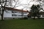
Johannes-Vincke-Schule

Heideweg
49191
Lower Saxony, Germany
mapOpen on Google Maps

Belm in OS
Belm in OS
Share experience

Nearby Places

Prince-Bishopric of Osnabrück

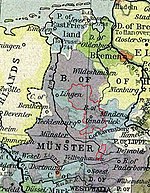
The Prince-Bishopric of Osnabrück) (German: Hochstift Osnabrück; Fürstbistum Osnabrück, Bistum Osnabrück) was an ecclesiastical principality of the Holy Roman Empire from 1225 until 1803. It should not be confused with the Diocese of Osnabrück (German: Bistum Osnabrück), which was larger and over which the prince-bishop exercised only the spiritual authority of an ordinary bishop. It was named after its capital, Osnabrück. The still-extant Diocese of Osnabrück, erected in 772, is the oldest see founded by Charlemagne, in order to Christianize the conquered stem-duchy of Saxony. The episcopal and capitular temporal possessions of the see, originally quite limited, grew in time, and its prince-bishops exercised an extensive civil jurisdiction within the territory covered by their rights of Imperial immunity. The Prince-Bishopric continued to grow in size, making its status during the Reformation a highly contentious issue. The Peace of Westphalia left the city bi-confessional and had the Prince-Bishops alternate between Catholic and Protestant. The bishopric was dissolved in the German Mediatisation of 1803, when it was incorporated into the neighboring Electorate of Hanover. The see, the chapter, the convents and the Catholic charitable institutions were secularized. The territory of the see passed to Prussia in 1806, to the Kingdom of Westphalia in 1807, to Napoleonic France in 1810, and back to Hanover in 1814. With the end of the prince-bishopric, the future of the diocese became unclear. Klemens von Gruben, titular Bishop of Paros in Greece, was made vicar apostolic of Osnabrück, and as such cared for the spiritual interests of the Catholic population. The ordinary Latin (Roman) Catholic episcopacy was restored in 1824, but henceforth the bishops would no longer wield any temporal power.

Widukindland
Widukindland

Widukindland is a district of Osnabrück, Germany. It is situated in the north-east of the city, on the slopes of the Schinkelberg (Schinkel Hill). It arose from the former boundaries of Schinkel. The Freiheitsweg (Freedom Way) and the Heimatweg (Homeland Way) were built in 1922. This settlement north of Bremer Straße was transformed under Nazi rule in the 1930s into a small housing estate area. The zeitgeist of that era remains evident in the names of the district's streets today: for example “Vaterlandsweg” (Fatherland Way), “Kameradschaftsweg” (Comradeship Way), “Sigiburgweg” (Sigiburg Way), “Freiheitsweg” (Freedom Way), “Heimatweg” (Homeland Way), “Sachsenweg” (Saxon Way) and “Cheruskerweg” (Cherusci Way). During the planning stages, it was made sure that every house had a garden to promote self-sufficiency. Since 1977 the area has been home to an important telecommunications tower. The street “Freundschaftsweg” (Friendship Way) was built in 1953. This district, characterised by its prevalence of single-family homes, large gardens and wooded areas, covers an area of 271.1 hectares and is home to about 4,700 people. Good infrastructure is provided for its residents, namely: good public transport links (city bus lines 71, 72, E31 and Nachtbus (night bus) N7) good medical provisions (general practitioner, dentist, pharmacy, HHO treatment centre, ergotherapy practices) a primary school a youth centre (Jugend und Kultur im Widukindland e. V.) two denominational kindergartens and a children's store a Lutheran parish (Timotheus) a Catholic parish (St. Boniface) two sports clubs (TSV Widukindland, VfB Schinkel) local shops (bakery, fishmonger, florist etc.) service providers (garages, banks/savings banks, driving schools, hairdressers, beauticians, furniture dealerships, sanitary fitters) various restaurants (traditional/local, Japanese, Chinese, Italian) The Schinkelberg green belt and the Gartlage, along with several meadows and fields, give residents good opportunities for recreation. The district derives its name from the legendary Saxon duke Wittekind. Many of its streets and open spaces bear the names of notable Saxon tribes and also local personages.

Dodesheide
Dodesheide

Dodesheide is a town in the borough of Osnabrück, Germany; with a population of roughly 7,900 residents it is located to the north-east of the city. Its boundaries are delineated in the north by the Vehrter Landstraße, in the west by the landwehr – a former defensive line around the town consisting of a bank and ditches – in the south by the Sandbach and the Osnabrück-Bremen railway line; the city boundary itself marks its eastern border. It is made up of sections of the former districts of Schinkel and Haste. The district’s most significant building is the Haus Gartlage, a former Jesuit seat which some years ago was converted into residences. Apart from this and a number of farms, most of the developments in the Dodesheide district are from the 20th century. Since the 1950s, the construction of residential space following set construction stages has been systematically encouraged; one notable case is the “Dodeshaus” model building project from the 1960s, focused on the area between Haster Weg and Ellerstraße where primarily bungalows are situated. The eastern part of the district continues to be characterised by the barracks of the British army and the attached soldiers’ residences; their final withdrawal in 2009 led to expectations of extensive structural change in the area. There are two churches in Dodesheide: the Thomaskirche (Protestant) and the St. Franziskus Church (Catholic). At the beginning of the 1970s, the possibility of making Dodesheide the location of the planned University of Osnabrück was discussed; in the end, however, the district of Westerberg was chosen. Its main offices are located at the Schloss Osnabrück (Osnabrück Palace). A remnant of the planning from that time remains in the form of the Dodesheide student residence located on Mecklenburger Straße; with 206 residents it is today the second largest student residence in the town.The traditional perception of the name Dodesheide as linked to “Todesheide” (Death’s Heath) is most likely false. The name is assumed to derive from the Old German proper name “Dodo”: its proper meaning being “Dodos Heide” (Dodo’s Heath).