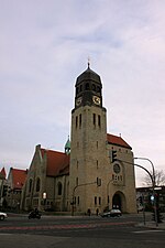
Schinkel (Osnabrück district)
Geography of Osnabrück
Schinkel is a district of Osnabrück, Germany, first mentioned in records in 1332. It is situated in the east of the city, into which it was incorporated on 1 April 1914. There are roughly 13,300 people in Schinkel. The name Schinkel is possibly a reference to the flank-like (Schenkel) form of the Schinkelberg (Schinkel Hill); however the exact meaning and origin of the name are unknown. Contrary to some claims it is unlikely that the district was named after the Prussian builder Karl Friedrich Schinkel. Colloquially and among local residents, the district tends to be referred to as “der” (the) Schinkel.
Excerpt from the Wikipedia article Schinkel (Osnabrück district) (License: CC BY-SA 3.0, Authors).Schinkel (Osnabrück district)
Tannenburgstraße, Osnabrück Schinkel
Geographical coordinates (GPS) Address Nearby Places Show on map
Geographical coordinates (GPS)
| Latitude | Longitude |
|---|---|
| N 52.2792 ° | E 8.0806 ° |
Address
Tannenburgstraße 95a
49084 Osnabrück, Schinkel
Lower Saxony, Germany
Open on Google Maps


