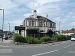
East Barnet
Areas of LondonEast BarnetUse British English from September 2015

East Barnet is an area of north London within the London Borough of Barnet bordered by New Barnet, Cockfosters and Southgate. It is a largely residential suburb whose central area contains shops, public houses, restaurants and services, and the parish church of St Mary the Virgin. East Barnet is close to the M25 and the A1 and M1.
Excerpt from the Wikipedia article East Barnet (License: CC BY-SA 3.0, Authors, Images).East Barnet
Cat Hill, London East Barnet (London Borough of Barnet)
Geographical coordinates (GPS) Address Website Nearby Places Show on map
Geographical coordinates (GPS)
| Latitude | Longitude |
|---|---|
| N 51.643 ° | E -0.163 ° |
Address
East Barnet Vets
Cat Hill 1
EN4 8HG London, East Barnet (London Borough of Barnet)
England, United Kingdom
Open on Google Maps


