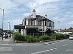
East Barnet Urban District
Districts abolished by the London Government Act 1963Districts of England created by the Local Government Act 1894East BarnetHistory of HertfordshireHistory of local government in London (1889–1965) ... and 4 more
History of the London Borough of BarnetLocal Government Districts created by the Local Government Act 1858Local government in HertfordshireUrban districts of England

East Barnet Valley was a local government district from 1863 to 1965 around the town of East Barnet. It was partly in the counties of Hertfordshire and Middlesex until 1889, when the Middlesex part was transferred to Hertfordshire. It was renamed East Barnet in 1935.
Excerpt from the Wikipedia article East Barnet Urban District (License: CC BY-SA 3.0, Authors, Images).East Barnet Urban District
Eton Avenue, London East Barnet (London Borough of Barnet)
Geographical coordinates (GPS) Address Nearby Places Show on map
Geographical coordinates (GPS)
| Latitude | Longitude |
|---|---|
| N 51.643 ° | E -0.161 ° |
Address
Eton Avenue 2
EN4 8TU London, East Barnet (London Borough of Barnet)
England, United Kingdom
Open on Google Maps


