place

Mira Loma High School

1960 establishments in CaliforniaAccuracy disputes from March 2022High schools in Sacramento, CaliforniaInternational Baccalaureate schools in CaliforniaPublic high schools in California
Use mdy dates from October 2011

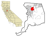
Mira Loma High School is a public high school located in Arden-Arcade, California, United States. It is located south of Interstate 80, and east of Watt Avenue. It is a part of the San Juan Unified School District with a student body of approximately 1700 students from northeast Arden-Arcade and western Carmichael. Mira Loma High School has been an IB World School since 1989, and is the largest International Baccalaureate program in Northern California. Mira Loma also achieves consistently high pass rates for IB exams, taken in May. According to Mira Loma, in 1996–1997 the school had a pass rate of 93%, with a 100% diploma attainment rate for students. In 2007–2008 the pass rate was 93% with a 100% diploma attainment rate. Both statistics are well above both the North American average (78%) and the world average (81%) for diploma attainment. For the 2015–2016 school year, Mira Loma has the highest average SAT score in the Sacramento area.

Excerpt from the Wikipedia article Mira Loma High School (License: CC BY-SA 3.0, Authors).

Mira Loma High School
Norris Avenue,

Geographical coordinates (GPS) Address External links Nearby Places
placeShow on map

Wikipedia: Mira Loma High SchoolContinue reading on Wikipedia

Geographical coordinates (GPS)

Latitude Longitude
N 38.633055555556 ° E -121.37111111111 °
placeShow on map

Address

Mira Loma High School

Norris Avenue
95841
California, United States
mapOpen on Google Maps

linkWikiData (Q6872216)
linkOpenStreetMap (32674628)

Share experience

Nearby Places

Auburn Boulevard

Auburn Boulevard is a major thoroughfare in Sacramento County, California, United States, and a tiny portion in Placer County, California carrying surface street traffic through the local communities of North Sacramento, Arden-Arcade, Foothill Farms, Citrus Heights, and Roseville. It was formerly part of U.S. Route 40, a former cross-country highway connecting downtown Sacramento to Roseville and points beyond. To a lesser extent, most of Auburn Boulevard was also part of U.S. Route 99E, an eastern branch of the former U.S. Route 99, now succeeded by State Route 99. Auburn Boulevard was also known as part of both the Lincoln Highway and the Victory Highway during the period from 1915 until the late 1920s when the custom of named highways gave way to the convention of numbered highways in the U.S. Highway System. It served as US 40 in North Sacramento until the completion of the North Sacramento Freeway (present day State Route 160 and Business 80/Capital City Freeway) in the early 1950s, and that section was redesignated US 40 Business until the mid-1960s. The section of Auburn Boulevard east of Howe Avenue continued to carry US 40 until the completion of the Roseville Freeway (also present day Business 80/Capital City Freeway) in 1959. US 40 was ultimately decommissioned in 1964 when California renumbered most of its highways. Interstate 80 in California is the successor to US 40. For most of its length, Auburn Boulevard is a four-lane roadway carrying local and regional traffic. It is still known for the long chain of motels, trailer parks, restaurants, and gasoline stations that exist along its length that were built in the 20th century to accommodate the travelers of the automobile age.

The Salt Box

The Salt Box was a house built in the early 1880s in the Bunker Hill section of Los Angeles, California. Designed in the saltbox style that was popularized in New England, it was originally located at 339 South Bunker Hill Avenue (231 South Bunker Hill prior to a renumbering in the early 1890s). It was the home of physician Dr. A.G. Cook for most of the 1880s. In the late 19th century, Bunker Hill was one of the most prestigious neighborhoods in Los Angeles and was the site of many elegant Victorian homes. The Los Angeles Times wrote of old Bunker Hill: "Nowhere else in Los Angeles was the architecture so ornate. The mansions were wooden-frame Victorian with Gothic gingerbread touches applied with a heavy hand to simulate masonry." Though not as elegant as many of its Victorian neighbors, the Salt Box was "cherished by architecture students for the simplicity of its design." In the 1950s, the Los Angeles Community Redevelopment Agency adopted a redevelopment plan for the Bunker Hill area. In the early 1960s, historic preservationists began efforts to preserve the Salt Box and another Bunker Hill mansion, known as the Castle. When the Los Angeles Cultural Heritage Board was formed in August 1962, the Salt Box was one of the first structures designated as a Historic Cultural Monument (HCM #5) on the Board's first day of business. The Castle received historic designation in May 1964, becoming Historic Cultural Monument #27. For several years after the Salt Box received historic designation, efforts continued to find a way to save the structure while still making room for redevelopment. By 1968, all of the Victorian homes of Bunker Hill Avenue had been demolished, except for the Salt Box and a second home, called the Castle. In August 1968, the Los Angeles Times urban affairs editor, Ray Herbert, wrote an article indicating that the two homes were to be demolished the following month to make room for a $500 million skyscraper development. Herbert noted that plans to relocate them to a planned Heritage Park had failed: "The end has come for Bunker Hill's two remaining turn-of-the-century mansions." Carl Mason, president of the Southern California Chapter of the American Institute of Architects said, "If it was just these two buildings, it wouldn't be so disturbing, but it's symptomatic of a lack of respect for our past -- of no one giving a damn about our heritage." In September 1968, with demolition set for October 1, 1968, the Salt Box and the Castle were saved when the Los Angeles Recreation and Park Commission voted to move the two structures to city-owned land in Montecito Heights where the Heritage Square Museum was eventually built. Finally, in March 1969, the Salt Box and the Castle were moved to their new home in Montecito Heights to become center-pieces for the planned Heritage Square. Both structures were badly deteriorated after years of neglect, and a fundraising campaign was launched to raise money to restore the two homes. In October 1969, just seven months after the move, both structures were destroyed in a fire ignited by vandals. The Los Angeles Times reported that the two structures had been invaded by vandals and youths who used them for parties since they were relocated. The house was photographed earlier in 1967 by Guy Webster and featured prominently on the cover of blues guitarist Taj Mahal's self-titled debut album, released in early 1968. At the time the house was still in its original location, surrounded by a barbed wire fence.