place

KYDS

California radio station stubsRadio stations established in 1978Radio stations in Sacramento, CaliforniaSacramento, California stubs

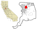
KYDS is a Sacramento, California FM radio station with the frequency 91.5 MHz. It is maintained at El Camino Fundamental High School, and select students from the school are allowed to participate in its operation. The original inception of KYDS was in 1976, when it broadcast only in the school cafeteria during lunch hour. KYDS originally received its FCC broadcast license in 1978 as one of the last Class "D" licensed FM stations in the country. The station went on the air with 10 watts of power (transmitter power output, not effective radiated power), into a 4-bay antenna and broadcast a monaural signal that effectively covered a 5-mile radius. Do to the COVID-19 pandemic and a campaign to modernize, the station now broadcasts on the internet on KYDS.rocks

Excerpt from the Wikipedia article KYDS (License: CC BY-SA 3.0, Authors).

KYDS
El Camino Avenue,

Geographical coordinates (GPS) Address Nearby Places
placeShow on map

Wikipedia: KYDSContinue reading on Wikipedia

Geographical coordinates (GPS)

Latitude Longitude
N 38.609 ° E -121.362 °
placeShow on map

Address

El Camino Fundamental High School

El Camino Avenue
95864
California, United States
mapOpen on Google Maps

Share experience

Nearby Places

Auburn Boulevard

Auburn Boulevard is a major thoroughfare in Sacramento County, California, United States, and a tiny portion in Placer County, California carrying surface street traffic through the local communities of North Sacramento, Arden-Arcade, Foothill Farms, Citrus Heights, and Roseville. It was formerly part of U.S. Route 40, a former cross-country highway connecting downtown Sacramento to Roseville and points beyond. To a lesser extent, most of Auburn Boulevard was also part of U.S. Route 99E, an eastern branch of the former U.S. Route 99, now succeeded by State Route 99. Auburn Boulevard was also known as part of both the Lincoln Highway and the Victory Highway during the period from 1915 until the late 1920s when the custom of named highways gave way to the convention of numbered highways in the U.S. Highway System. It served as US 40 in North Sacramento until the completion of the North Sacramento Freeway (present day State Route 160 and Business 80/Capital City Freeway) in the early 1950s, and that section was redesignated US 40 Business until the mid-1960s. The section of Auburn Boulevard east of Howe Avenue continued to carry US 40 until the completion of the Roseville Freeway (also present day Business 80/Capital City Freeway) in 1959. US 40 was ultimately decommissioned in 1964 when California renumbered most of its highways. Interstate 80 in California is the successor to US 40. For most of its length, Auburn Boulevard is a four-lane roadway carrying local and regional traffic. It is still known for the long chain of motels, trailer parks, restaurants, and gasoline stations that exist along its length that were built in the 20th century to accommodate the travelers of the automobile age.