place

Magothy River

Rivers of Anne Arundel County, MarylandRivers of MarylandTributaries of the Chesapeake Bay

The Magothy River runs 12.1 miles (19.5 km) through Anne Arundel County in the U.S. state of Maryland. It is located south of the Patapsco River and north of the Severn River. There are two public park paddling access points, Beachwood Park on the north shore a half mile east of the Magothy Bridge Road bridge, and Spriggs Farm Park off Bayberry Drive, on the south shore two miles west of the Magothy's mouth. Both are Anne Arundel County parks.

Excerpt from the Wikipedia article Magothy River (License: CC BY-SA 3.0, Authors).

Magothy River
Broadwater Road,

Geographical coordinates (GPS) Address Nearby Places
placeShow on map

Wikipedia: Magothy RiverContinue reading on Wikipedia

Geographical coordinates (GPS)

Latitude Longitude
N 39.056111111111 ° E -76.434444444444 °
placeShow on map

Address

Broadwater Road

Broadwater Road
21056
Maryland, United States
mapOpen on Google Maps

Share experience

Nearby Places

Little Magothy River

The Little Magothy River runs 2.5 miles (4.0 km) through Anne Arundel County in the U.S. state of Maryland. It is located southeast of the Magothy River, just outside its mouth and north of the Severn River. A small, mostly tidal river, the Little Magothy's watershed (not including the water surface) covers an area of 2.2 square miles (5.7 km2). All mailing addresses in the watershed are in the Annapolis zip code, and the entire watershed is within Anne Arundel County, on the north side of the Broadneck Peninsula. It is bordered on the west by the community of Cape Saint Claire, and on the east by houses and farms along Bay Head Road. It runs just west of Sandy Point State Park. It starts near College Parkway and US 50/301, just north of the Whitehall Creek watershed (which is part of the Severn River watershed that drains to Whitehall Bay), and it flows north into the Chesapeake Bay south of Gibson Island. It has one named nontidal creek that drains into its upper end, Cat Branch, which flows under Cape Saint Claire Road. According to "My River Speaks," p. 141, Cat Branch was dammed in the mid-18th century to supply water through a canal to a mill in the upper Whitehall Creek watershed (part of the Severn River watershed). The 6.5 miles of Chesapeake shoreline including the Little Magothy River and stretching to Sandy Point, all well beyond the official mouth of the Magothy (which is 325 meters south of the southern tip of Gibson Island) are not in the Magothy drainage basin but are often included in county and state government studies of the Magothy watershed.

Baltimore Harbor Light

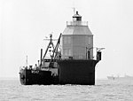
The Baltimore Harbor Light, officially Baltimore Light and historically Baltimore Harbor Lighthouse is a privately owned caisson lighthouse in the Chesapeake Bay in Maryland. First lit in 1908, it sits at the mouth of the Magothy River, marking the channel which leads northwest to the opening of the Patapsco River, which then leads into the Baltimore harbor. The light is located adjacent to the mouth of the Magothy River. At the time of its construction, it was the world's tallest caisson lighthouse. In June 2006, Baltimore Light was sold at auction to private owners by the General Services Administration for $260,000; the U.S. Coast Guard maintains rights to operate a light on the structure.Although a lighthouse had been requested at the site since 1890, it was not until 1904 that construction actually began. In October of that year a violent storm struck the construction site, upturning the caisson and sending it to the bottom of the Bay. The contractor defaulted on the work, and it was not until late in 1905 that construction could resume. The lens was finally installed and the light lit in 1908. It was the last lighthouse to be constructed on the Chesapeake.In May 1964, the Baltimore Light became the first and only American lighthouse powered by nuclear power, as a test of the SNAP-7B 60 Watt radioisotope thermoelectric generator. One year later the RTG was removed and a conventional electric generator was installed. Currently the lighthouse is solar-powered. The structure was added to the National Register of Historic Places as Baltimore Light Station on December 2, 2002.