place

Stowgate

Hamlets in LincolnshireLincolnshire geography stubsSouth Kesteven DistrictThe DeepingsUse British English from December 2013

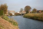
Stowgate is a small settlement in the South Kesteven district of Lincolnshire, England. It is situated approximately 2 miles (3 km) north-east from Deeping St James, and is linked to the Deepings group of villages. Stowgate contains very few houses, most of which are farmhouses. The settlement grew up around Stowgate Farm – the farmhouse of which still exists – which was divided into a number of smaller farms intended to provide housing and agricultural land for those who contributed to war effort. These farms still exist. Stowgate contains a Bernard Matthews turkey farm.

Excerpt from the Wikipedia article Stowgate (License: CC BY-SA 3.0, Authors).

Stowgate
Cranmore Drove, South Kesteven Deeping St. James

Geographical coordinates (GPS) Address Nearby Places
placeShow on map

Wikipedia: StowgateContinue reading on Wikipedia

Geographical coordinates (GPS)

Latitude Longitude
N 52.6808 ° E -0.2382 °
placeShow on map

Address

Cranmore Drove

Cranmore Drove
PE6 8RW South Kesteven, Deeping St. James
England, United Kingdom
mapOpen on Google Maps

Share experience

Nearby Places

Northborough, Cambridgeshire

Northborough is a small village and civil parish in the Peterborough district, in the ceremonial county of Cambridgeshire, England. It has a pub, a shop, a school and a small castle. Northborough is around eight miles north of the city of Peterborough and one mile south of village of Deeping Gate and the Lincolnshire border. The place-name "Northborough" is first attested in the Anglo-Saxon Chronicle for the year 656, where it appears as Northburh. In an Assize Roll of 1202 it appears as Norburg. The name means 'northern burg or fortified settlement'.Northborough Manor House is a fortified manor house, largely built by Roger de Norburgh in the early fourteenth century. A short way away is the parish church of St Andrew, of which the original Norman sections date back to the late twelfth century. After the restoration of the monarchy Elizabeth Cromwell, widow of Oliver, lived with John Claypole (her son in law) and is said to be buried in this church. However, there is no grave-stone or marker to be seen.The village underwent its largest change in the 1970s, when it expanded hugely with the building of the new estate, increasing the population of the village. Northborough also has a small primary school, which also takes children from other neighbouring villages, such as Maxey and Peakirk. Until relatively recently, the school was housed in the School House, almost opposite the manor along the Lincoln Road. Then, as the village grew, it moved to a new, larger and better equipped site. The school benefits from a large field and adjoining orchard.

Peakirk
Peakirk

Peakirk is a village and civil parish in the Peterborough district, in the ceremonial county of Cambridgeshire, England. For local government purposes it forms part of Glinton and Castor ward; for parliamentary purposes it falls within Peterborough constituency. In 2001, the parish had a population of 321 persons and 139 households.Pega (died c. 719), the sister of St Guthlac of Crowland, had her cell sited here. The privately owned, Grade-II-listed St Pega's Hermitage is possibly on the site. The parish church is uniquely dedicated to St Pega and the name of the village is derived from "Pega's church". The church is a Grade I listed building and has a fine series of wall paintings. It is said that Pega's heart was kept as a relic in the church, contained in a heart stone, the broken remains of which, smashed by Cromwell's troops, can be seen in the south aisle window.The Wildfowl & Wetlands Trust, founded by Sir Peter Scott in 1946 to preserve and maintain Britain's many species of waterfowl, had a reserve here until 2001.Peakirk-cum-Glinton Church of England (Voluntary Aided) Primary School is situated in neighbouring Glinton; most secondary pupils attend Arthur Mellows Village College, also in Glinton. Peakirk's war memorial is a roll of honour. An oak-panelled frame with 48 photographs and details of the service of all who served from the village during the First World War, not just those who died.Peakirk Parish Council declared a climate emergency in 2019. As a result, the Peakirk Climate Emergency Group was set up in 2020.

Deeping Fen
Deeping Fen

Deeping Fen is a low-lying area in the South Holland district of Lincolnshire, England, which covers approximately 47 square miles (120 km2). It is bounded by the River Welland and the River Glen, and is extensively drained, but the efficient drainage of the land exercised the minds of several of the great civil engineers of the 17th and 18th centuries. Drainage schemes were first authorised during the reign of Queen Elizabeth I, but from 1632, a group of adventurers took control of the drainage, in return for which they were granted land. They faced the problem that the outfalls of the River Welland and the River Glen were not sufficiently low to enable proper drainage by gravity, and most schemes included improvement to the rivers. John Perry, an engineer of some repute, who had set the standard for engineering reports in 1727, began work in 1730, and was followed by John Grundy, Sr., a pioneer in applying scientific principles to civil engineering problems. His son, John Grundy, Jr., was another capable engineer, who was retained as a consultant after he resigned as full-time Surveyor of Works. In 1800 the civil engineers William Jessop and John Rennie assisted local engineers with plans for improvements, the chief of which was for a steam pumping station. This plan was not implemented immediately, but two steam engines fitted with scoop wheels were installed at Pode Hole in 1823. The pumping station was the largest in the Fens at the time, and remained so for many years. Steam gradually gave way to diesel engines and scoop wheels were replaced by centrifugal pumps, and the diesel engines were then replaced by electric motors. However, the beam engine and scoop wheel at Pinchbeck Marsh, which ran from 1833 to 1952, was not scrapped, and can be visited by the public. From 1801 the fen was managed by trustees, appointed under the terms of an act of Parliament obtained in that year, and this remained the case until 1939 when the administrative structure was replaced by the Welland & Deepings Internal Drainage Board.