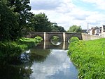
Frognall
Lincolnshire geography stubsSouth Kesteven DistrictThe DeepingsVillages in Lincolnshire

Frognall is a small village in the South Kesteven district of Lincolnshire, England. It is situated just north-east of Deeping St James , to which it is almost conjoined, and on the Spalding Road, the B1525, which becomes the A1175 road on its route northwards from The Deepings to Spalding. It is within the civil and ecclesiastical parish of Deeping St James. The village public houses used to be The Goat and the Rose Inn. The Rose Inn closed down in 2013.
Excerpt from the Wikipedia article Frognall (License: CC BY-SA 3.0, Authors, Images).Frognall
Frognall, South Kesteven Deeping St. James
Geographical coordinates (GPS) Address Nearby Places Show on map
Geographical coordinates (GPS)
| Latitude | Longitude |
|---|---|
| N 52.677 ° | E -0.281 ° |
Address
Frognall
Frognall
PE6 8RS South Kesteven, Deeping St. James
England, United Kingdom
Open on Google Maps


