Phipps Bridge tram stop

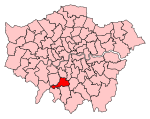
Phipps Bridge tram stop is a stop on the Tramlink service in the London Borough of Merton. The stop is named after Phipps Bridge Road, an adjacent residential street. The tram stop consists of a single island platform. Immediately to the west of the station is a single-track section which reaches as far as Morden Road tram stop. To the east, double track continues to the nearby Belgrave Walk tram stop, which is clearly visible from Phipps Bridge tram stop. Access to the platform is via pedestrian level crossings over the tracks. To the north a footpath gives access to Phipps Bridge Road. To the south, a gateway gives pedestrian access to the National Trust's Morden Hall Park, which borders the line to the south for a considerable distance each side of the stop.
Excerpt from the Wikipedia article Phipps Bridge tram stop (License: CC BY-SA 3.0, Authors, Images).Phipps Bridge tram stop
New Close, London Merton (London Borough of Merton)
Geographical coordinates (GPS) Address External links Nearby Places Show on map
Geographical coordinates (GPS)
| Latitude | Longitude |
|---|---|
| N 51.403583 ° | E -0.182626 ° |
Address
Phipps Bridge
New Close
SW19 2SY London, Merton (London Borough of Merton)
England, United Kingdom
Open on Google Maps


