Merton Abbey, London
Areas of LondonDistricts of the London Borough of MertonUse British English from September 2015
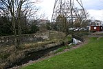
Merton Abbey is an area in southwest London, England. It lies between South Wimbledon and Colliers Wood in the London Borough of Merton. Merton Abbey takes its name from Merton Priory, which once stood on the northern edge of the district. The area is bounded by Merton High Street to the north, the River Wandle to the west, Christchurch Road to the east and Deen City Farm to the south. Despite the area being considered by many to be part of neighbouring Colliers Wood, most of Merton Abbey falls within Merton's "Lavender Fields" ward. The area is within the SW postcode area.
Excerpt from the Wikipedia article Merton Abbey, London (License: CC BY-SA 3.0, Authors).Merton Abbey, London
Yarborough Road, London Merton (London Borough of Merton)
Geographical coordinates (GPS) Address Nearby Places Show on map
Geographical coordinates (GPS)
| Latitude | Longitude |
|---|---|
| N 51.41243 ° | E -0.18142 ° |
Address
Yarborough Road
Yarborough Road
SW19 2RH London, Merton (London Borough of Merton)
England, United Kingdom
Open on Google Maps


