Zuid-Beijerland

Zuid-Beijerland is a village in the Dutch province of South Holland. It is a part of the municipality of Hoeksche Waard, and lies about 10 km south of Spijkenisse. The village was originally called Den Hitsert. The current name was first used between 1839 and 1859. It is named after the eponymous polder. Zuid (south) has been added to distinguish from Oud-Beijerland and Nieuw-Beijerland. Zuid-Beijerland developed as a dike village after the polder was enclosed with a dike in 1631. It became an independent parish in 1671. The Dutch Reformed church is a cruciform church with needle spire which was built in 1933 after its predecessor burnt down.Zuid-Beijerland was home to 798 people in 1840. It was a separate municipality until 1984, when it became part of Korendijk, which itself later became Hoeksche Waard.
Excerpt from the Wikipedia article Zuid-Beijerland (License: CC BY-SA 3.0, Authors, Images).Zuid-Beijerland
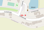
Jacob Pauwstraat, Hoeksche Waard
Geographical coordinates (GPS) Address Nearby Places Show on map
Geographical coordinates (GPS)
| Latitude | Longitude |
|---|---|
| N 51.751388888889 ° | E 4.3677777777778 ° |
Address
Jacob Pauwstraat 27
3284 XG Hoeksche Waard
South Holland, Netherlands
Open on Google Maps


